| mvermeulen.org : Home Blog Bike Trips |
Hawaii! This was the destination for my winter bicycle trip. I had chosen the Big Island of Hawaii as a winter destination in part due to the weather and in part because bicycling distances involved. A normal circumnavigation of the Big Island is ~220 miles leaving plenty of extra time to relax or to explore. In total I traveled 355 miles in eight days of cycling.
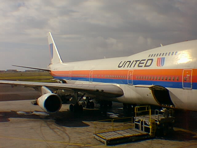
One inch of wet snow in Boston on my departure. Changed planes in Chicago where the connecting DC-10 was delayed. Apparently, the plane had come from the hanger, with a door accidentally frozen open. It turns out my exit row window seat was immediately next to and behind said door. I figured this out after watching the flight attendant's nervous expression on the take off, and also feeling the extra cold draft coming under the door. The flight attendant tried in vain to hide her expression, but I quietly confirmed things after we landed in Honolulu.
I accidentally didn't check my baggage through to Hilo, thus missed the Aloha Airlines to Hilo. Good news was I got on the next standby flight. Bad news was I came into Hilo after dark.
Pitch dark as I bicycled out the airport. I carefully rode along the edge of the road. One mile out I hear a sharp hissing sound. Flat tire! What a way to start! Walk almost mile until I reach the first street light. Fix the tire and cycle along to Dolphin Bay Hotel at 8pm (1am EST).
Leave about 7am at sunrise. Warm humid air. Shorts and a T-shirt. Slight rolling hills getting out of Hilo, including a nice overlook looking back at the town. About seven miles out I took a 4-mile scenic route off the main road. The route crossed tunnels formed by tropical trees, several one lane bridges and a winding hills. Too early to see the botanical gardens.
Back to the main road at Onomea. An adequate 2ft shoulder, but also a lot of traffic. Saw a lot of sugar cane, some Papayas and also Macadamea nut trees. Slight rolling hills as with a rugged coast line below. Occasional beach parks. Passed turnoff to Akaka falls. Took a short break at Laupahoehoe, stopping at a small store. It was already getting warmer. This was Hamakua coast known for ample rain and the sugar cane that grows there. One evening later that week Honokaa received eight inches of rain, luckily I was already past.
Outside Laupahoehoe the road crosses several gulches, a quick descent into the gulch and then a climb up the other end. At Ookala, the route decided to climb to 500ft for good. It was already warm and I was sweating. Was starting to get a little tired at Honokaa at 1000ft. Lunch as Texs. Outside Honokaa the road climbed in earnest, ~1250 feet in five miles. Those five miles took an hour by themselves.
Afterwards the road slowly leveled off. Cattle country! Home of Parker Ranch, some 310 sq miles and the largest private ranch in the USA. Gently rolling hills as I entered Waimea. I stopped in at the Parker Ranch Visitor Center (an ok visitor film but save the $5 for something else). In the evening I had dinner with my sister-in-law's mother and sister and got to sleep early.
4100 feet of climb and 300 feet of descent today. Left Waimea in the cool morning air. Initial six miles went quickly as they descended about 300 feet. At this point, I turned off to the Saddle Road which cuts across the middle of the island. Rental cars are forbidden on this road (my opinion is this seems to be an overly paranoid).
A brief period of flat before the road started heading up. The edges of the road are beat up, but otherwise the road is fine. A climb of 3100+ feet in the first ten miles. These ten miles went slowly as I was somewhat out of shape and heavily loaded (now why did I bring this laptop PC again :-)). Route continued with short grasses and cattle. Also occasional areas with trees. Saw many hunters and also several pheasants.
After ten miles the road levels and even has a slight dip. From here, the remaining nine miles climb only 1000ft at a much more comfortable pace. I was rationing four bottles of water, but luckily had enough along the way. Passed an army base and then made it to the State Park. Waited until 2pm to check in, and then slept in a rental cabin.
In the early evening a thin veil of clouds covered the moon. Later at night it cleared and the moon set leaving a beautiful clear sky of stars. Seven thousand feet higher in the observatories at the summit of Mauna Kea, it must have been even more spectacular.
Descent! Bad brakes!
I decided to descend and spend an extra day in Kona rather than around Mauna Kea where I originally had two nights reservations. In part this was because I'd been hungrier than expected and otherwise would run out of food.
Morning air at 6500ft was cool. I put on mittens, a flannel shirt and long pants. The first eight miles of descent were steeper than I remembered. No pedaling required. I did notice that my rear brakes kept rubbing, the right pad would keep making contact even when pushed aside.
After gliding for eight miles, there were several rolling hills before the steep descent started. The rear brake continued to squeak loudly, but I decided I'd rather have it rubbing than go without rear brakes. Still I tried to favor the front only and go slower than I otherwise would have. Still the overall descent of 4100ft was slightly less than an hour compared to nearly four hours of climb. Just think of how fast it could have been with proper brakes!
Once back to main Waimea/Kona road, the route leveled to rolling hills. I disabled the rear brake to let me travel without it rubbing the wheel. The shoulder varied between 2ft and nothing. Luckily traffic would give me adequate berth. The route crossed some pretty rugged, dry terrain with prickly pear, short grass and some recent lava flows. The route was mostly level, but did descend more than it climbed.
At ten miles from Kona I descended through the 2000ft level, crossing the lava flow of 1801 and passing a lookout. Shortly thereafter the route got steep again. I re-enabled the brake. I reached the outskirts of Honokohau and descended sharply into Kona.
After lunch I found a local bike store. The bike mechanic spent about an hour of his time and $15 of my money in fixing and adjusting the rear brakes. Stayed at the Kona Seaside Motel and explored the town.
Rest day. Explored town. Swam in the ocean. Read a book. Relaxed. Typical Hawaii stuff.
On the road early. 6:30am to 6:30pm are pretty much the daylight limits in the winter in Hawaii. The road rolled a little but climbed rapidly to Kealakekua and Captain Cook. Each 500ft contour was marked and the 1500ft level was just past Captain Cook.
Coffee country. Many low coffee bushes. Also a few tourist buses. Fairly narrow and winding road. There was a long traffic jam in Captain Cook, but I zipped along the right hand side, hoping not to antagonize motorists who would later pass.
Brief stop at Hookena turnoff. Afterwards crossed a nature area with older trees. Also crossed a larger Macadamea Nut farm. Stopped at 1700ft at a wayside park for lunch. While at lunch it started to rain, mostly light drizzle, but enough to get me worried. Luckily it subsided after lunch. As I made my way around the South Cape, the wind started to pick up.
I passed "Ocean View" which bills itself as the World's Largest Subdivision. Clearly a place that looks better in the marketing brochures than in reality. Large amounts of barren lava on the side of an active volcano. Apparently the water source is catchment, with any extra purchased at 5 cents per gallon. The entire complex ranges between 500 and 5000ft in altitude.
As I passed Ocean View, I passed the 2000ft contour and was already close to Naalehu. It was early, so I decided to take a 12-mile road descending to the ocean at South Point. This is the southern most point in the USA. The descent was great! The road was initially wide, but after a mile and a half, the road it narrowed so that two cars could not pass each other staying on the road.
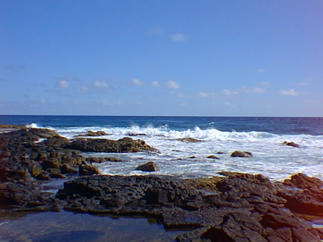
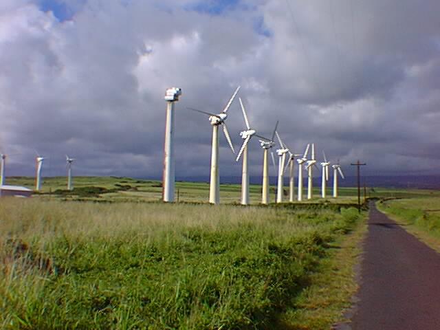
Descend! Descend! Descend! Brakes worked fine. The road passed several windmill generators which were stopped due to light winds. Not too long after, I reached the ocean. I saw a sign and took a detour to the "Information Center". This was a farce. A small closed building with a pamphlet on the wall. Some water I didn't completely trust. I went back and down to the main point.
It was after 2pm, so I only spent half an hour at the point. It was noticeably warmer than it had been above. I turned around and started a slow climb uphill. Luckily I consulted my detail map to find a turnoff at 1500ft that saved me the last 500ft of climbing.
Got to the main road and then down to Naalehu and Becky's B&B. The B&B was nice and Chuck and Becky were friendly.
Large breakfast. 7:30 start. Descended from Naalehu the last 800ft down to the ocean. Landscape was dry and barren. Just a few low rolling hills. Down and across. Passed by a turnoff to black sand beach known for turtles nesting there.
Turned briefly in to Pahala. Small town: post office, grocery, gas station. Back out. Not too long before Pahala, the climb had started. 4000ft in ~25 miles. Relatively gentile climb. Initially some Macadamea Nut trees, but then more dry scrub brush. This region was in the rain shadow from Kilauea so it was very dry.
Slow and steady climb. Entrance to the park was 2840ft. High point summit was 4024 feet. After that slight descent as I cycled around the rim of the crater. Stayed at Volcano House, the hotel in the park. Nice walk to steam vents and other places. Evening rain.
Stayed at Volcano House, the hotel in the park. Early morning overcast, but it cleared enough so I decided to cycle the eleven mile route around the Kilauea Caldera. The Caldera is the summit crater. It is a site of occasional eruptions including a lava lake lasting 100 years ending in the 1920s. However, most of the eruptions on the Volcano are along the sides and not the summit. This includes the current eruption that has been pouring 500,000 cubic meters of lava per day since 1983.
The Caldera is a study in climate contrasts. One half receives <30 inches per year and looks dry, barren, "moon walk" sort of country. The other half receives >130 inches per year and is tropical rain forest. As I cycled I encountered a brisk ~25MPH wind. Great as a tail wind, but taking some extra effort as a head wind. I visited a lookout at the Jaggar Museum and also walked through the underground Thurston lava tube. Both worth one's while!
After doing the 11 mile tourist loop, I watched another film at the visitor center and listened to a ranger talk. I cut the last one short since I was getting cold standing in the windy drizzle. 11:30am and time to seek warmer ground.
Descent! Once again, I descended several thousand feet. I had a sharp head wind arresting my descent so even needed to pedal occasionally. It got progressively warmer as I made my way past Glenwood, Mountain View and Kea'au. Here I took a turnoff through Pahoa.
Pahoa left me with an impression of being an ex-hippie/progressive/etc. town. Lots of interesting characters wandering the streets. An occasional rusted VW micro-bus. I continued through Pahoa to stop at Pearl's Shell B&B. Another delightful place to stay!
Left about 8:30am headed for the coast. I first cycled towards Kapalana at the coast. This town had been destroyed by lava flows. The road itself was closed to further traffic at mile 21. A large steam plume was visible in the background where the lava entered the ocean.
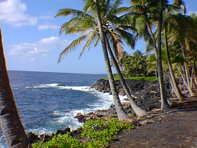
I turned along the coast and cycled 137 along the coast. The first few miles were well paved, but then the road became very rustic. Areas with poor pavement, narrow roads, beautiful coastline, whales in the ocean. The ironwood trees were visible at Mackenzie State Park and the surfers were found at Isaac Hale Beach.
I continued to the intersection with 130 where a 1.5 mile dirt road led to Cape Kumukahi. This is currently the easternmost point. However this is still an area of active lava flows. Apparently, the flow of 1960 destroyed a nearby village but neatly avoided the lighthouse as the flow split in two. I saw two other bicycle tourists on the same route.
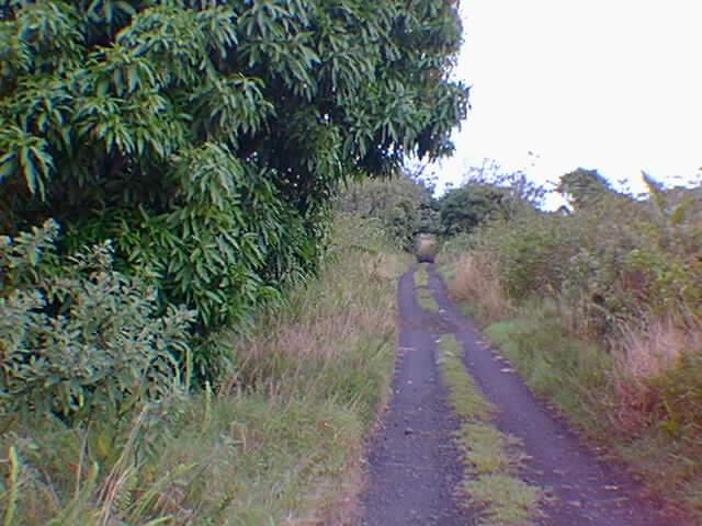
I rejoined 130 for a trip along the coast. The road continued becoming even more rustic. Pavement stopped after a few miles. I cycled the gravel/dirt path through the trees. After Honolulu Beach, I crossed a subdivision. At this point the road was replaced with "Puna Trail". As I headed down the trail, I quickly reached a narrow jeep trail that was very difficult to cycle. I walked for the next few miles with my bicycle to the next subdivision: Hawaiian Paradise Park.
Cycled back uphill through Hawaiian Paradise Park before rejoining the main road for a fairly quick ride back in to Hilo. Arrived about 3:30 and spent the rest of the day exploring town.
Left in the early morning dark to cycle back to the airport. Aloha Airlines had no bicycle boxes ("we are a small airline, we don't stock boxes"). Sent the bicycle through without a box. Luckily all was well when I picked it up in Honolulu. Here I boxed things for an uneventful trip back home.
Hawaii was a wonderful place for a winter cycling break. Distances are relatively short, although there are some steep climbs and descents to make up for that. Enough to explore in a week, but also enough to spend even more time.
Now time to start planning the next trip!