| mvermeulen.org : Home Blog Bike Trips |
The overall plan is to spend a week or so cycling from Brownsville along the Rio Grande Valley and then back to Austin. Weather averages are favorable, though small chance of cold down to freezing or strong wind or rain. Nothing like real winter further north, but still enough to make it unpleasant. Depending on the weather, I'll adjust my route to go more or less directly. Still having shorter hours of daylight also cuts into the distances.
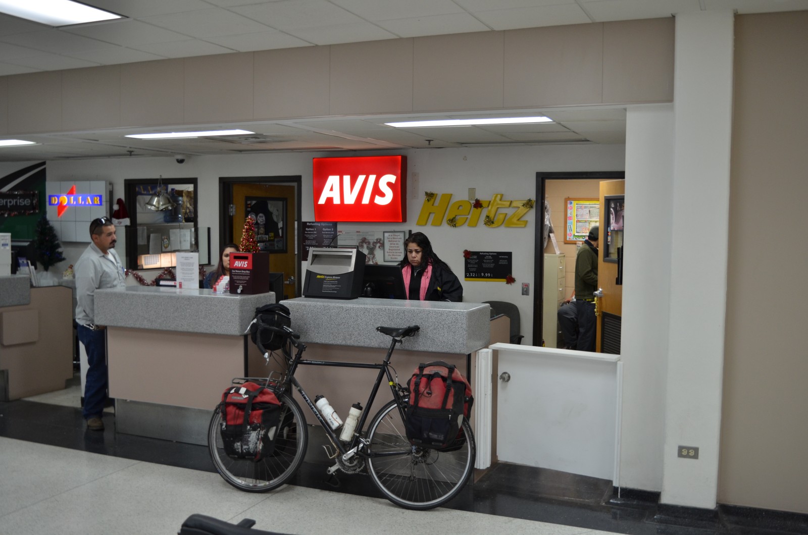
Today drove ~220 miles and still have ~130 miles to go tomorrow.
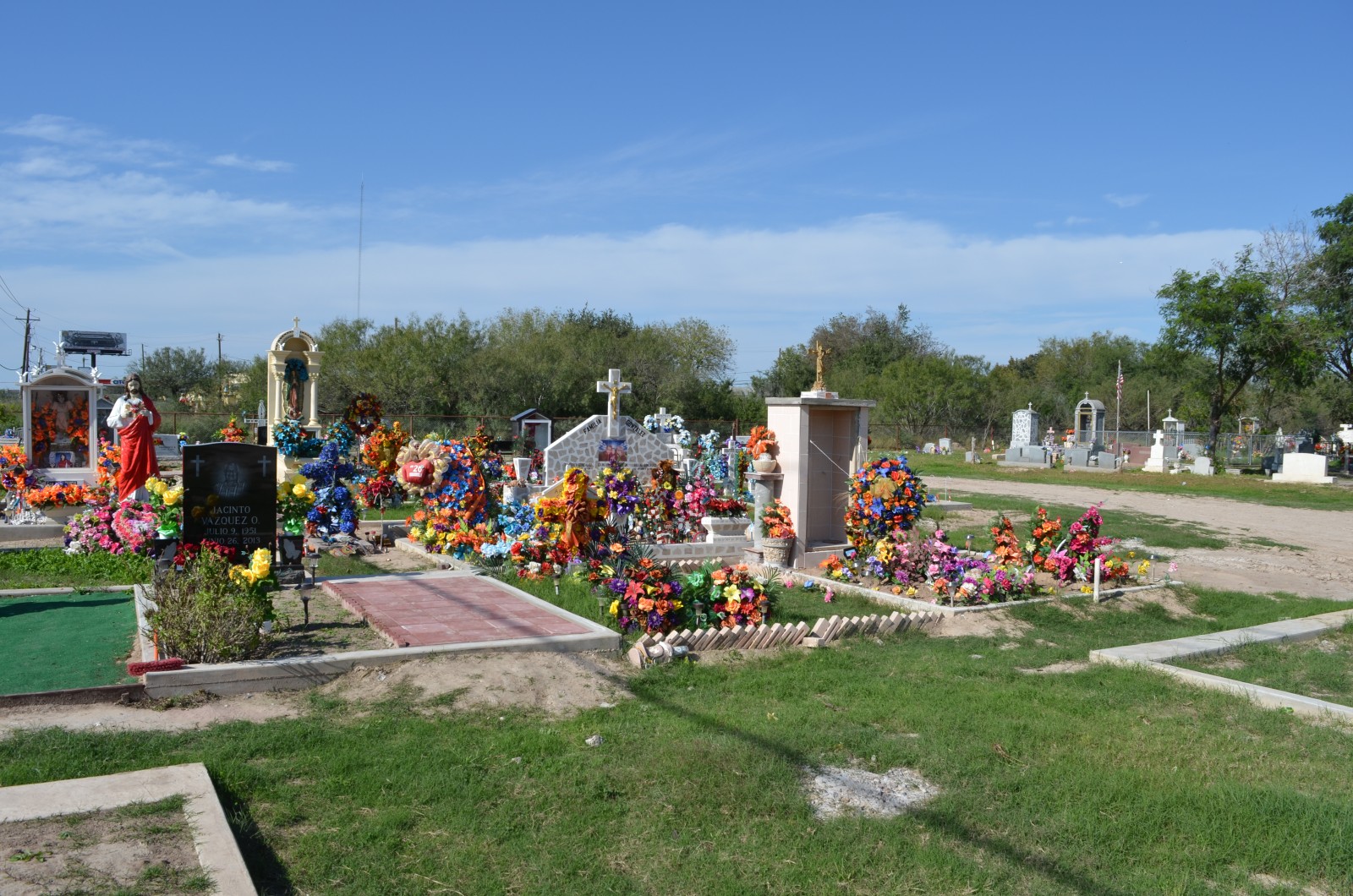
Initially the route took me through Brownsville, though with shops closed for Christmas and otherwise light traffic, it was peaceful. I stayed north of the center of the city as well as closest points of border to Metamoros. After crossing under US77, the road was named either 281 or Military Highway for the next 49 miles.

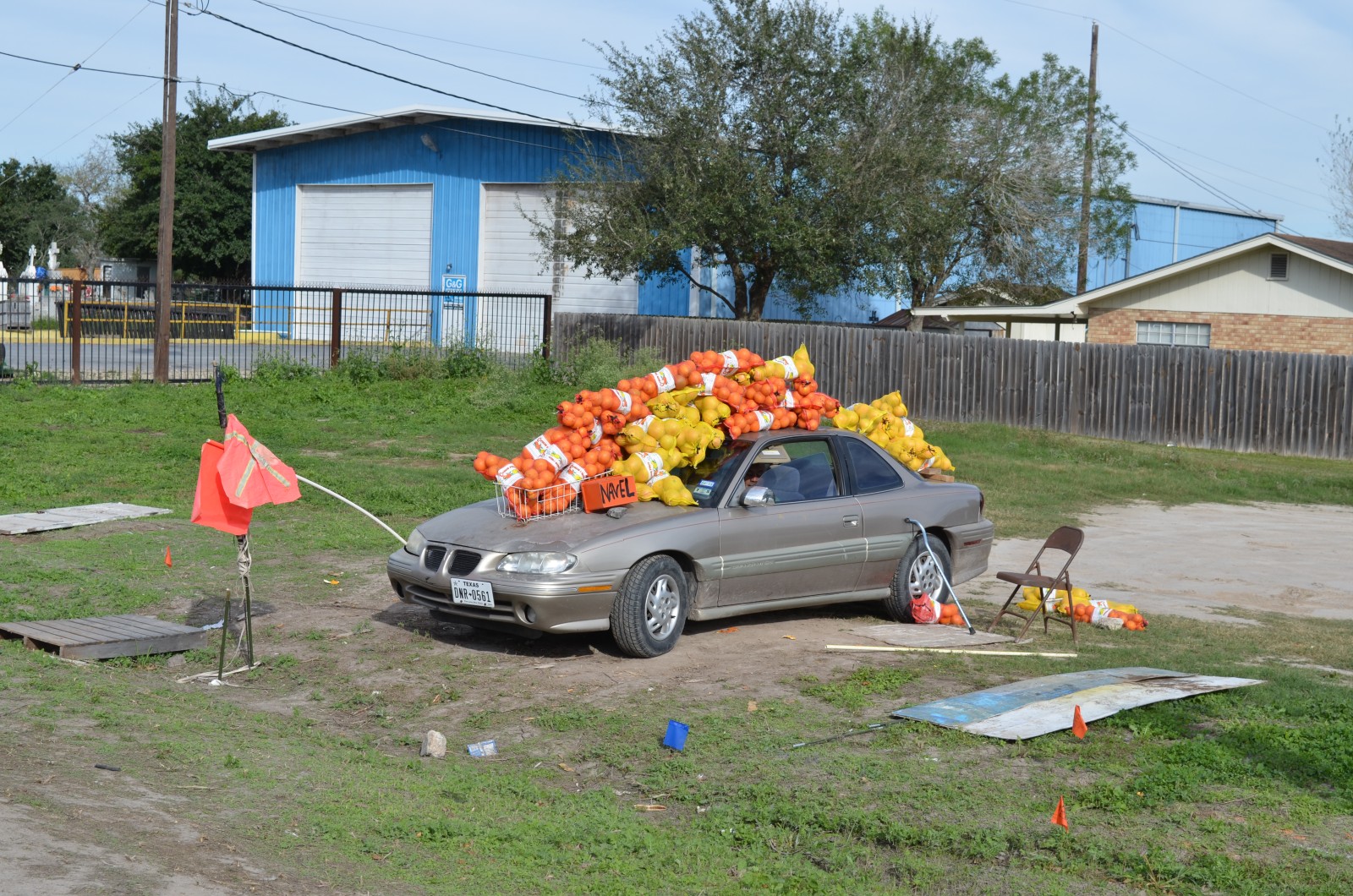
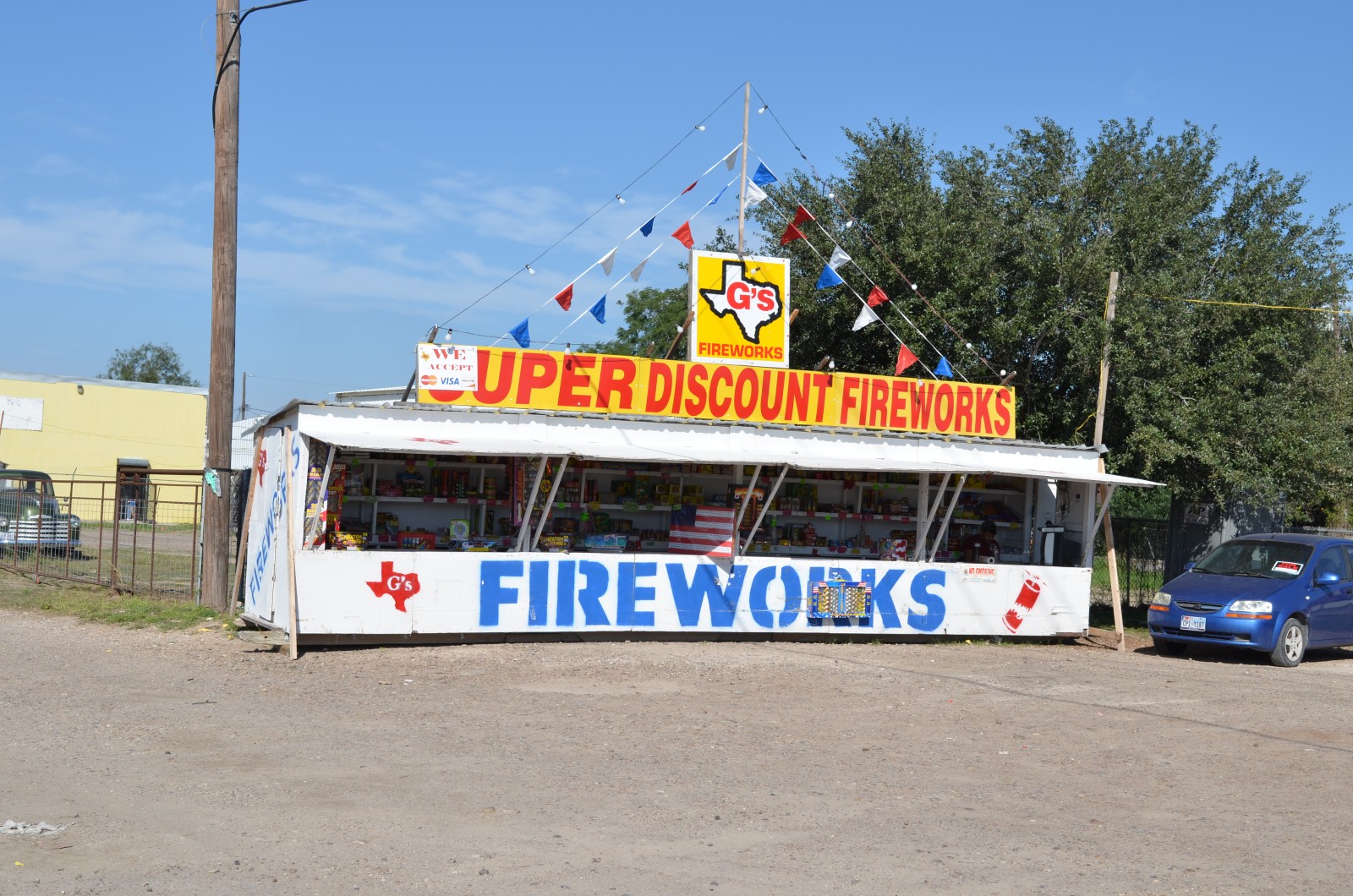
 Primary commercial places I saw open were either fireworks stands or a few
vendors selling citrus from out of their cars. With fresh legs, a tuned
bicycle and flat terrain - the riding was easy. I stopped briefly to take
some photos of the border fence. There were only a few spots where I saw
this fence. Other places, the fence either doesn't exist or was further away.
I also didn't see any of the Rio Grande River despite taking the most direct
route along it. This area was a flat floodplain and in few spots it might
have been close, there would be levees blocking any views. So much for
Rio Grande "Valley".
Primary commercial places I saw open were either fireworks stands or a few
vendors selling citrus from out of their cars. With fresh legs, a tuned
bicycle and flat terrain - the riding was easy. I stopped briefly to take
some photos of the border fence. There were only a few spots where I saw
this fence. Other places, the fence either doesn't exist or was further away.
I also didn't see any of the Rio Grande River despite taking the most direct
route along it. This area was a flat floodplain and in few spots it might
have been close, there would be levees blocking any views. So much for
Rio Grande "Valley".
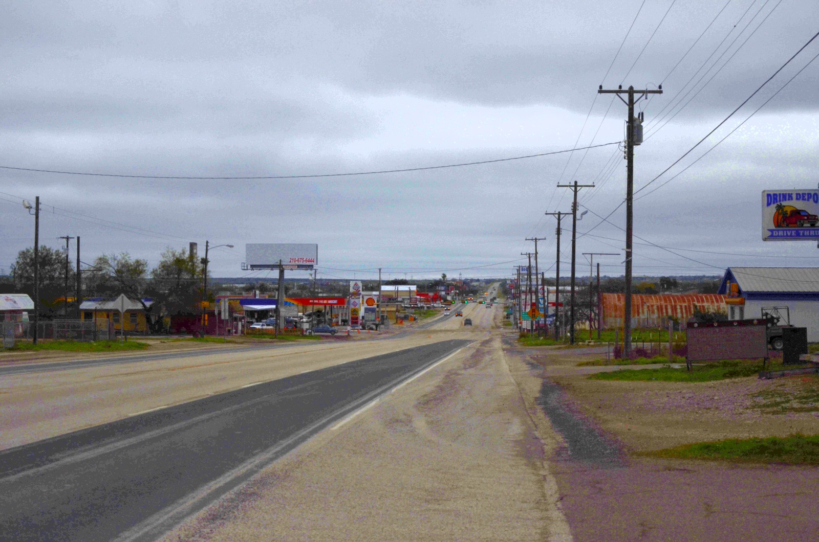
Another commericial spot open was gas stations, "Stripes" was a common brand.
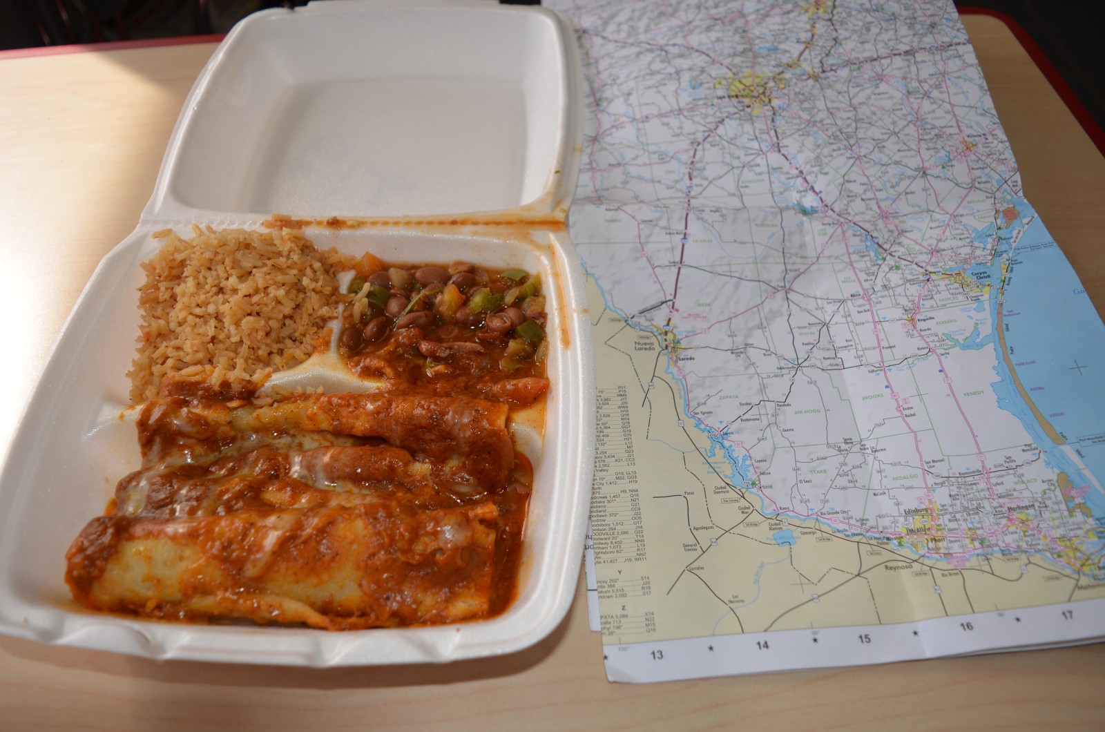
I ended up getting both lunch and dinner from this chain. It was at 37 miles
that I stopped for lunch. I had forgotten to charge my GPS, but had enough
directions printed and could use a cell phone to catch (the rare) turns.
Several spots on the way had signs for international bridges to Mexico, and
there were also companies here focused on trading.
The miles slowly counted down to Pharr, until Pharr wasn't far. I then passed through it and turned right at Hildago. A few more turns through outskirts of McAllen and then Mission before I met back up with US 83. I followed frontage road here, which worked well except for short stretch of shoulder work, where it was only one lanes. The impatient cars had to wait for me on those brief stretches and most were polite.
At 70 miles found a hotel and had Stripes nearby. Figured this was good spot
to stop for the day and cleaned up and relaxed.
 Started at 7:30am after a breakfast at local Stripes. The first five miles
were on "Business 83" which had good shoulder and not much traffic. There
wasn't much business on this business route, despite shops being open.
At 5.8 miles, the road met with US83 which I then followed for rest of the
day. There was considerably more traffic on this road. However, except for
narrow spots leading into Roma and the last few miles to Zapata, there was a
broad shoulder.
Started at 7:30am after a breakfast at local Stripes. The first five miles
were on "Business 83" which had good shoulder and not much traffic. There
wasn't much business on this business route, despite shops being open.
At 5.8 miles, the road met with US83 which I then followed for rest of the
day. There was considerably more traffic on this road. However, except for
narrow spots leading into Roma and the last few miles to Zapata, there was a
broad shoulder.
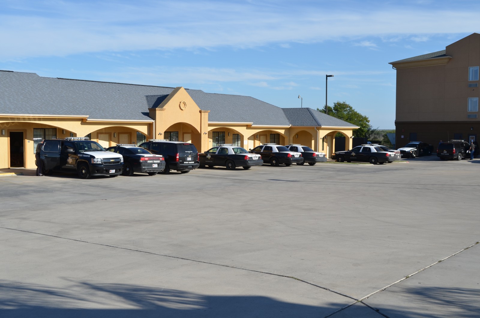
There continued to be a large number of state patrol cars on the road. At end of the day, my motel had 18 state highway patrol cars and one other vehicle. I asked one of the troopers and he indicated "the governor sent us down". So apparently, an increased enforcement in the Rio Grande Valley, pulling troops from all over the state. I again saw half a dozen cars stopped, so as whole probably kept car speeds down and safer overall.
Going into La Joya at mile 9 I saw motel that would otherwise have been my choice yesterday. That would have worked too. After that, there were some gentle rises and falls. It got busier as I reached Rio Grande City. This was also good spot for a mid-morning break at 30 miles. After this, it was warmer on the road and also seemed somewhat busier. Some more gentle rises and falls until about 40 miles and then last miles into Roma were flat. I saw several restaurants as I neared the 45 mile mark. However, passed them up assuming once I crossed downtown, I would find a place to eat lunch on the outbound stretch.
 After mile 45, I crossed through the older downtown and then started heading
out. Surprise! No businesses at all. There was a high school and middle
school with a big stadium and after that it was completely open country. I
was fortunate to have a big shoulder. I cycled on and figured I'd stop at
first reasonable spot for lunch. I passed the turnoff for Falcon Lake State
park and crossed a few more hills. Finally at 63 miles I found a spot for
lunch.
After mile 45, I crossed through the older downtown and then started heading
out. Surprise! No businesses at all. There was a high school and middle
school with a big stadium and after that it was completely open country. I
was fortunate to have a big shoulder. I cycled on and figured I'd stop at
first reasonable spot for lunch. I passed the turnoff for Falcon Lake State
park and crossed a few more hills. Finally at 63 miles I found a spot for
lunch.
 The last 22 miles were pretty straightforward. Some gentle rises and falls
but not much wind and overall made good time. Road got worse the last three
miles into Zapata. It was good day overall at 85 miles. Not much after
Zapata for a while so also good place to stop.
The last 22 miles were pretty straightforward. Some gentle rises and falls
but not much wind and overall made good time. Road got worse the last three
miles into Zapata. It was good day overall at 85 miles. Not much after
Zapata for a while so also good place to stop.
After cycling through Zapata, the route kept going over some slight rises/falls on way to San Ygnacio. Shoulders were still good and traffic was light. The wind did start picking up slightly.
San Ygnacio had two gas stations and I stopped in at the first for quick snack. After this point, the route was flatter, but signs said "Road Construction 6 miles". The road narrowed and not much shoulders but as I got close to the 22 mile mark, was anticipating end of road construction. Unfortunately, the road narrowed and for next miles had no shoulder and more traffic. Next file miles was very careful riding with construction on my right.
After that I had several miles where a newly paved shoulder was blocked off on the left. Given the choice between a six inch shoulder and a fifteen foot shoulder (facing traffic), I crossed over and cycled on left for a while. Finally at the Webb County Line the construction stopped. Unfortunately, the shoulder got both wider and much rougher. It as a chip-seal without much seal. The wind also picked up.
I slowly cycled another 10 miles on the awkward shoulder against the wind until came into outskirts of Laredo. From here some city streets to end the ride. What would have been a very easy ride was a bit tougher with wind and road construction. In the evening more of the front came through along with some rain.
On the way out of town, I stopped at HEB for few items since there wouldn't be any stores along the way. At mile 4, the route left Laredo and not much after that. US59 had nice shoulder and every 10 miles or so would widen to have passing lanes. Fewer ups and downs as well so straightforward but cool riding.
Along the route was mostly wide open scrub land, with some cactus. I saw a few cows, a few raptors in the telephone poles and not much other animals. There were signs of oil and fracking industry. A few pumps close to freer and also areas with tanks. I stopped every 10 miles or so and had a few fig newtons and otherwise continued.
At 45 miles was an immigration check point. I waited in line behind several cars. When it was my turn, I was asked, "Are you a US citizen?" I said yes and he let me go through.
 At 60 miles another road joined and shortly thereafter came into Freer.
The town had one traffic light but surprising number of motels. I got lunch
and then stopped to find the largest rattlesnake before finding a motel.
It never did warm past the high 40s so was nice to get into a warm room.
Definitely notice when touring that 40s all day is a bit cool. Tomorrow
expected to start colder, but sun out should make it warmer in afternoon.
At 60 miles another road joined and shortly thereafter came into Freer.
The town had one traffic light but surprising number of motels. I got lunch
and then stopped to find the largest rattlesnake before finding a motel.
It never did warm past the high 40s so was nice to get into a warm room.
Definitely notice when touring that 40s all day is a bit cool. Tomorrow
expected to start colder, but sun out should make it warmer in afternoon.
 Not much otherwise for the first 42 miles leading to Tilden. As I entered
town, I saw a number of work trucks and other signs of the oil patch.
Stopped in at store for lunch. Outside was a washing station to wash worst
mud off your boots. Inside, the prices were adjusted higher.
Not much otherwise for the first 42 miles leading to Tilden. As I entered
town, I saw a number of work trucks and other signs of the oil patch.
Stopped in at store for lunch. Outside was a washing station to wash worst
mud off your boots. Inside, the prices were adjusted higher.
Heading north through town, came with junction of TX 72. Here the truck
traffic dramatically increased on 16. Some of it turned at 48 miles where
sign indicated trucks could fill on water. However, overall was one of the
busiest roads I'd ridden on this week. Slowly rode until mile 72 or so where
came into Jourdantown. Cycled through town and then turned right towards
Pleasanton. Found a reasonable motel and stopped for the day.
 Weather forecast called for an arctic air mass to come late this afternoon
and stay for a few days. Further north, this storm would result in
temperatures below 0F. Nothing so severe here, but temperatures close to
freezing and good chance of drizzle.
Weather forecast called for an arctic air mass to come late this afternoon
and stay for a few days. Further north, this storm would result in
temperatures below 0F. Nothing so severe here, but temperatures close to
freezing and good chance of drizzle.
I considered my options: (1) I could try cycling as quickly as I could to Austin - two days riding but last one could be wet and very cold (2) I could ride to San Antonio Airport, rent a car to drive back and (3) I could find a motel in San Antonio, spend New Years there and continue when weather was more favorable.
I had some time in my vacation, motel rates weren't outrageous and it looked like San Antonio had an interesting New Years Eve celebration attracting up to 250,000 people. So decided to pick the third choice.
Cycling into San Antonio from south was surprisingly easy - particularly compared to the busy roads I recall from north east. I first rode to middle of Pleasanton and then followed US 281 northbound. Traffic was very light, though surface of the wide road shoulder was very bumpy. At 9 miles I came through Leming and shortly thereafter turned left onto Old Pleasanton. Glad to leave that shoulder behind. This area was still rural with trees to block the NE wind and houses with barking dogs. It was easy cycling and by mile 20 I crossed 1604 one of the outer ring roads surrounding San Antonio. The road stayed surpringly rural most of the way to I-410, the inner ring road.
After I-410, sidewalks appeared and started to get regular city blocks. A
few miles to reach a McDonalds for late morning lunch and then took the city
streets in through San Antonio to reach the Alamo. After that found my
hotel, checked in for three days and relaxed.


I had cycled this route four times in past two years, so it was familiar riding. However, each of those times I was cycling in the other direction.
Left about 7:30am. Rode up to the zoo and then on New Braunfels street through Alamo Heights. Here I joined Nagadoches street. Traffic was still light as I passed 1604 and headed out past Bracken and Garden Ridge. At about 26 miles I briefly joined I-35 and then came in via New Braunfels. On the outbound side, I stopped for lunch at 35 miles.
Somehow after lunch felt colder than before. Took Post road into San Marcos and passed the stadium at 50 miles. From here was the back route into Kyle, along Buda and then back in Austin. Got back about 4:30.
Overall 464 miles over nine days including two rest days in San Antonio. A few cold days, but overall still reasonable riding over Christmas week.