| mvermeulen.org : Home Blog Bike Trips |
In May 2000, John Leo and I bicycled from San Jose to Las Vegas by way of Death Valley. Our original plans were also to visit Sequoia and Kings Canyon but we had to pass on this as you'll read below. This page provides a few highlights and pictures from the trip. Click on any image to see a full-sized view.
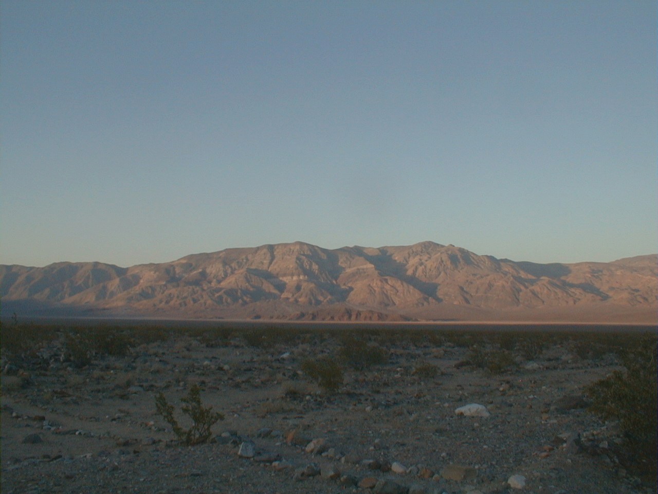
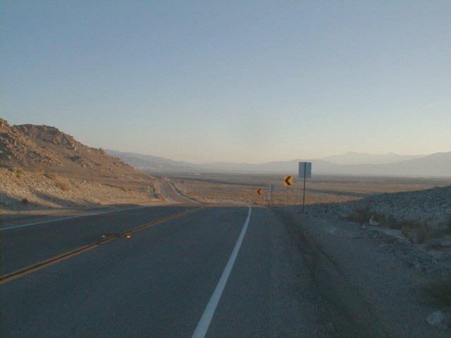
Picture on the left looks from Panamint Springs across the valley to the
Panamint mountains on the far side. Temperatures now cooling from the midday
90's as the sun sets. Shadows lengthening across the valley.
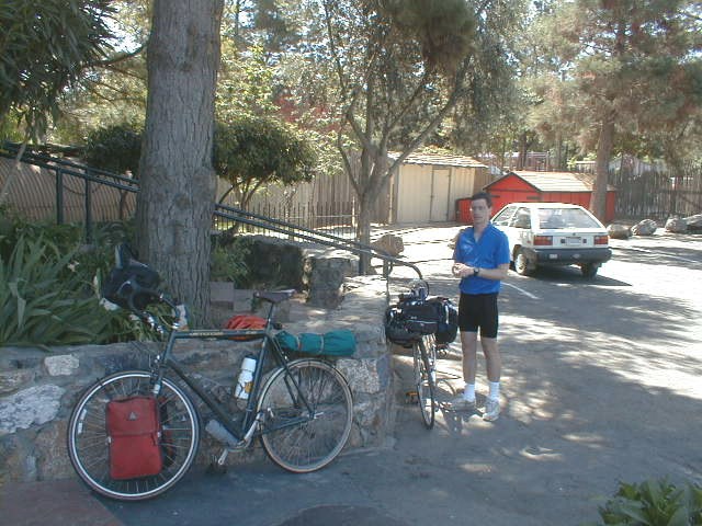
We stop for a quick bite in Morgan Hill. 26 miles for me and 42.5 miles for John. The first sun-block goes on. During the entire trip I'll use just over one full bottle of SPF 30. I will use neither my rain gear nor wool hat carried along as well. At Gilroy we turn and head out 156. Busy traffic but reasonable shoulder as we cross this two lane "headlights on" section of highway. Apparently, an overloaded route for commuters going from California's central valley and on into Silicon Valley from the south.
We climb one small bonus hill and the road becomes four lanes after 156 joins. Short while later we see signs for Casa de Fruta, with shade and a good excuse to stop before climbing the pass. Casa de Fruta seems to have an amusing naming scheme: Casa de Motel, Casa de Cafe, Casa de Zoo, etc.
Just as we exit the highway, I get a Casa de flat in my rear tire. Fortunately, easily fixed in the cool Casa de shade as shown in picture on the left. Good excuse for a Casa de break anyways.
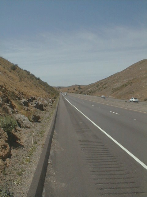
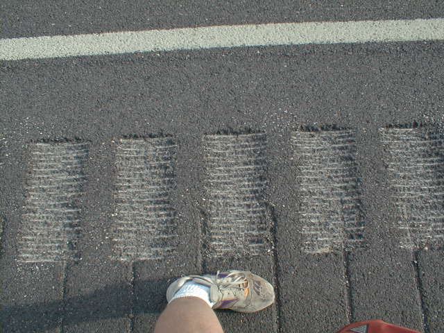
A few miles past Casa de Fruta, the climb begins. Fairly gentle and only 1400ft of climb, this is quickly done before a reasonable descent down the other side. The picture on right does show one problem with the descent. Highway engineers have gouged out a "rumble strip" in the shoulder. While this keeps sleeping motorists from drifting off, it also forces cyclists to make an unfortunate choice: right of the strip there is frequently debris on the road, left of the strip is close to traffic and riding on the strip is very rough. Sigh. I mostly try left of the strip.
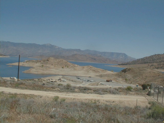
On descent, John gets a snake bite flat in his front tire, third one total for the trip. After this is fixed, we descend further stopping briefly in the visitor center for the San Luis Reservoir. After that, some last descent, cross I-5 and into Los Banos our tentative stopping point.
Mid-afternoon in Los Banos and we figure we can still do some more miles. One worry is John's right knee which has become rather painful, perhaps a re-injury from before the trip. We head out on four lane 152 figuring to stop in either Dos Palos or Chowchilla.
152 has a horrible road surface. Jarring cracks every fifteen feet or so. Enough, so that the combination of road and knee has us turn off on 33 and stop for the day in Dos Palos.
Dos Palos has two motels. We stay in the "Sundance", a somewhat rundown motel.
Payment is only in cash. Bedspreads are old and tattered. An old mirror still
has a placard for "wine and cheese hour in the lobby", but we suspect this came
with the mirror. We're the only guests for the night.

Mendota proudly proclaims itself, "Cantelope Capital of the World". Also a good spot for an early breakfast the the Burger King. The woman working the counter tells this is still primarily agricultural, with some people working in Fresno. In the 60's her father made $ by driving harvest trucks, making up to $3000 in a week. She raised five kids (now ages 13 to 30) and now does this job as a way to get out of the house.
After Mendota, road turns east. Almonds, plums, alfalfa, olives and other produce I don't recognize comes along the way. After stopping at Kerman we're told of road construction on 33 and thus detour one mile north on Belmont. With these flat and straight roads it doesn't make a big difference which road we ride. Not too much later we start to reach outskirts of Fresno.
Fresno appears to be a large sprawling town, not too much exciting I see on our route. While waiting for John, I meet a 60-year old out on his bicycle. He is enamored to learn more about bicycle touring and also leads us to a local bike store where we pick up an extra tube or so (just in case). A little ways past Fresno, stop at a place, "Michael's" for lunch. Feels good to already have 70 miles done.
After lunch, we start a slow grid pattern to south and east on the roads. The route crosses through smaller towns of Centerville, Minkler, Reedley, and Dinuba before ending at Visalia. We pass the turnoff on 180 to the parks with slight regret, but perhaps on a next trip.
Visalia is hosting a Soroptimist
convention and hence the downtown motels are full. Fortunately, we get a
pointer from one of the motels to find another place.
Many acres of orange trees. Some green leafy trees still full of oranges. Some green leafy trees picked clean and also occasionally trees with many unpicked oranges fallen below. Where they are picking one seems multiple cars and vans, a few porta-potties and people in ladders in the trees harvesting.
We take the side road through Lindsay, Strathmore and into Porterville. Town centers seem pretty deserted, perhaps with more of the business relocating to be along the highway. Porterville is a stop for breakfast. Around Porterville becomes less flat and starts to roll. Also here we see fewer orange trees and some spaces with open lands with wheat or other grasses.
The back roads take us in through Ducor pictured on left. At Ducor we rejoin the main highway, though it still isn't very busy. The day is definitely getting warmer as we go through the rolling terrain. Not too far from Bakersfield we do a several hundred foot descent. On the climb back, we start to notice many small pumping oil wells. We go via Oildale and the airport and find our way into the center of town.
Bakersfield has a nice downtown. A little quiet on a Sunday afternoon, but
wide streets with trees. We try without success to find a motel close into
downtown and end up back close to highway 99 and the road exit. There is
a car show in town, but we get a small taste with many interesting fixed up
cars in the parking lot.
High steep canyon walls made for a delightful and cool ride. Each bend we crossed through we'd see the next part of the canyon. The road was narrow, but it was still early without much traffic. After 18 miles or so, the canyon opened up. The main road became four lanes with more gentile broad grades. Even with those grades, I figure we must have climbed the same 100ft contour interval half a dozen times as the road would climb and descend and climb and descend.
It was hot by the time we reached the town of Lake Isabella. This town is below the dam and didn't look very interesting. Asking other tourists and at the visitor center, we were directed to Kernville on the North Kern River as the best place to stay. We finished the day in early afternoon and thus had time to explore.
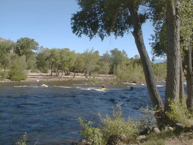
Kernville looks like a center for recreation, with climbing, kayaking, hiking
boating, fishing and other activities not too far away. The Kernville Inn was
nice in the center of town.
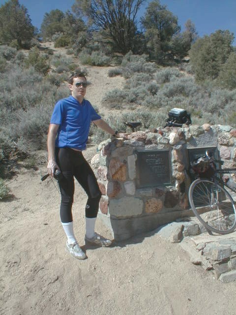
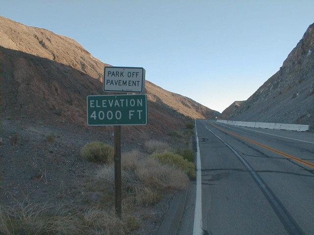
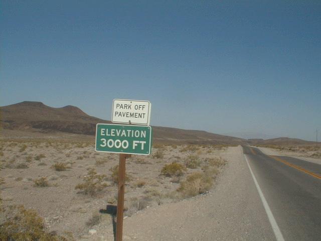
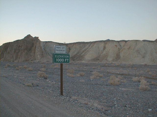
Lake Isabella is 2500ft and Walker pass was 5250ft. No sit down breakfast today. Instead a gas station (Onyx Emporium) and a chance to fill up with Gatorade and chocolate bars. Around Onyx the landscape changed, with a few Joshua Trees starting to appear. The road curved around a hill and started to follow a drainage slowly upward. Elevation signs indicated first 3000ft and then 4000ft. Not too much later we were at Walker Pass, pictured at left.
The descent from 5250ft Walker Pass down towards 2200ft Ridgecrest was delightful. Broad good road and ~6% descent. As we entered the Mojave, skies were very clear and there weren't many trees, hence you could see for miles across the valleys. All the more awe inspiring for me to see this broad landscape while riding a bicycle.
Eight miles from the pass, we reached US 395, followed it for four miles and then turned for more descent into Inyokern. Even though it was still mid-morning, the air was already quite a bit warmer. Inyokern's slogan was "A town on the move, with room to grow". From Inyokern, eight miles of straight flat, hot desert road to the China Lake Naval Weapons base and then a right turn into Ridgecrest.
We arrived just past noon. This was somewhat by design. As the days were starting to heat up, we were trying to get cycling done in the cool mornings and leave more of the warmer afternoons out to explore around town.
We walked around a fair amount of Ridgecrest. Unfortunately, it too had many
stores either closed or on the move. Bike store was closed on Sunday/Monday,
Bowling alley didn't open until 4pm, AAA offices moved to Kingville. We did
however find book stores, grocery stores and got a chance to see some of the
downtown.
Trona is a town of ~3000 people on the edge of Searles Dry Lake. IMC Chemicals has at least three plants we passed where they process lake salts. You can smell Trona for several miles around, perhaps more when the wind blows. In Ridgecrest we were amazed to see low prices advertised for real estate in Trona. One house was marked down from $15,000 to $10,000 and another was listed at $6,000. Compared to the SF Bay area quite a contrast (story in the San Jose Mercury before we left: median house price now exceeds $500,000 in Santa Clara county!).
Crossing into the Trona Valley, we slowly made our way past the chemical plants and small town before stopping for breakfast. We took the main road though there was also a very sorry looking bike path along the way (with much glass and also drifted sand).
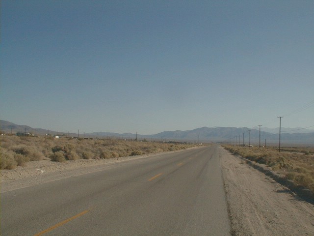
As we climbed out of Trona, the road became very quiet and desolate. Picture at left shows part of the route. The terrain sloped very gently and the the wide open space made it difficult to tell one was climbing. If one didn't know there was a climb here, the slower speed would be a bit frustrating.
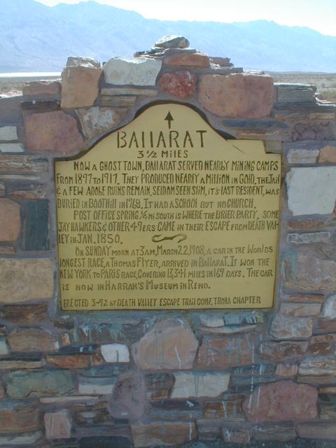
Slowly climbed up another 1200ft before a nice descent down into the Panamint Valley. Near the bottom of the descent was a sign pointing to Ballarat, now a ghost town. Otherwise, no signs of people living anywhere in the 50 miles between Trona and Panamint Springs.
A little past the Ballarat turnoff, the road suddenly became much worse. The road had a maze of tiny cracks. By themselves, this wouldn't be so bad. However, some crazy highway crew had decided to patch each of these cracks individually. The net effect was a network of raised bumps surrounding "tiles" of about a foot square. Many many bumps to ride over by bicycle. The worst bumpy section lasted a mile or two before finally ending close to the Emigrant Canyon turnoff.
Last 17 miles into Panamint Springs were very hot. I had carried 6 liters of water with me from Trona and drank my way through most of that. Only a slight tail wind and some slight downwind helped here. Last two and a half miles was a slow slog uphill. Fortunately, we got in by 1pm before the worst heat.
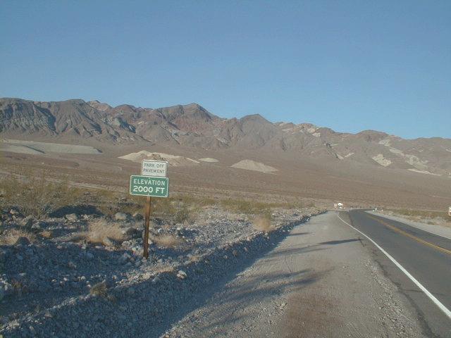
Panamint Springs, is a small resort motel at 2000ft elevation, just inside the boundaries of Death Valley National Park. Nearest gas is either 53 miles at Lone Pine or 35 miles at Stovepipe Wells. According to the motel workers, around once a day a vehicle finds itself stuck at Panamint. Today it was a RV motorhome with mechanical problems. They had fortunately broken down just before the motel at 10:30am. Called for a tow from Lone Pine which arrived at 4:30pm. Despite this setback the couple from Seattle was making the best of it, including even narrating the videotape of the adventure.
At Panamint we had to wait while the room was readied. Temperatures were up
to 94 degrees, but fortunately there was a large shade tree outside where I
read my book and otherwise stared out mesmerized at the shifting desert
scenery.


Fortunately, leaving early meant that the climb was still fairly cool. It
also got cooler as we gained altitude. There was some of the route where it
was more efficient to just walk than to bicycle. However, overall the climb
wasn't too bad. Shortly past 7:30am we were up at the top. At the summit
was one of these large tanks of radiator water (do not drink!).

At sea level was Stove Pipe Wells. A brief stop for an apple, chocolate and water before setting out 24 miles across the valley floor to Furnace Creek. This stretch passed by some tall sand dunes, the devils cornfield (plants holding in tall hills of dirt), the salt marsh and the old borax works. For the most part a reasonable road and not too hot yet. We got into Furnace Creek before noon. That afternoon the high temperatures were somewhere between 104 and 108 degrees.
We went to the visitor center and otherwise looked around the Furnace Creek area. Furnace Creek apparently is on the bus circuit for tours taken by foreigners. One minute we were quietly eating lunch, just after the bus arrived we were suddenly surrounded by by 50 French speaking tourists. Other busses also brought Japanese and other tourists.
We learned a bit more about the
origin of the name,
"Death Valley" coming from a lost set of '49ers looking for a short cut on
their way to the gold fields. Even though they came in December, this was
pretty clearly a much tougher journey. They ate some of their oxen and I
didn't even come close to thinking of eating my Cannondale.

|

|
|
|

|
At elevation ~700ft was Zabriskie point, an overlook onto many multicolored rocks. Still before sunrise, but a few tourist cars had arrived to see the early morning colors on the rocks. Slowly the route climbed along the canyon and left the main parts of Death Valley behind. Around 2000ft elevation is the last I could clearly see the main valley.
Also at 2000ft elevation, a head wind started picking up. The land opened up a bit more into a flat plain. The summit of the hill was just over 3000ft whereupon it started a 1000ft descent to Death Valley Junction. The head wind prevented me from fully taking advantage of this descent.
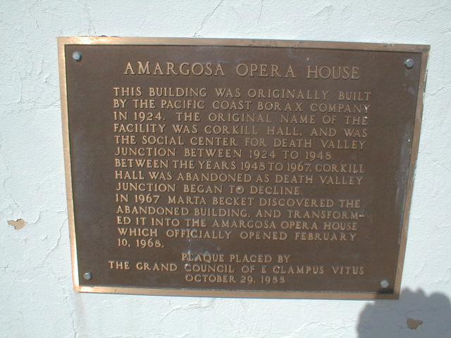
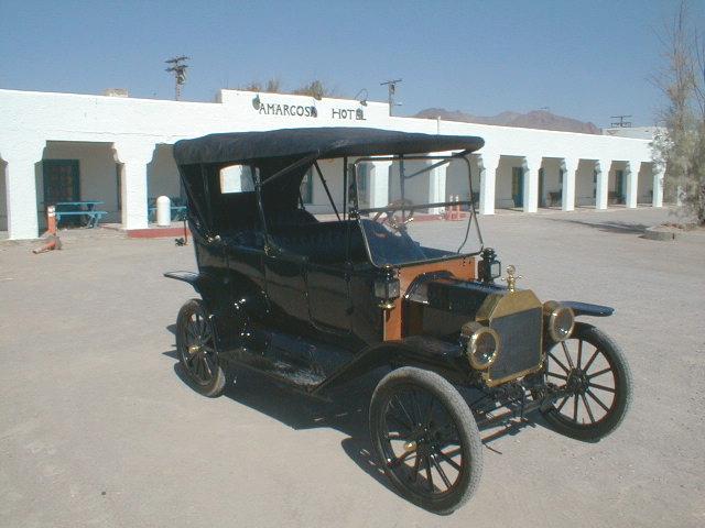
Stopped briefly at Death Valley Junction. This is home of the Amargosa Opera House, still operating once or twice a week. One can also stay at the hotel here.
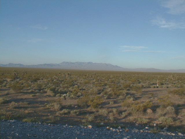
From Death Valley Junction, it is five miles of mostly flat until the Nevada Border. No official sign welcomes you to Nevada (or California), but the road surface changes and the county name also changes. After the border, the road curves around past Ash Meadows National Wildlife Refuge and turns southward towards Pahrump. We continued cycling into the head winds on this stretch.
A low climb takes one over and then down into Pahrump. Signs announcing the arrival of Pahrump were premature. For at least seven miles, I found myself cycling upwind and past sparsely populated parts of Pahrump. Fortunately, finally made it to center of town and motel for the evening.
While walking around Pahrump, also found that things were spread out. We
walked over to the bowling alley for a few games (136-88-128, not too bad)
and otherwise exploring town.
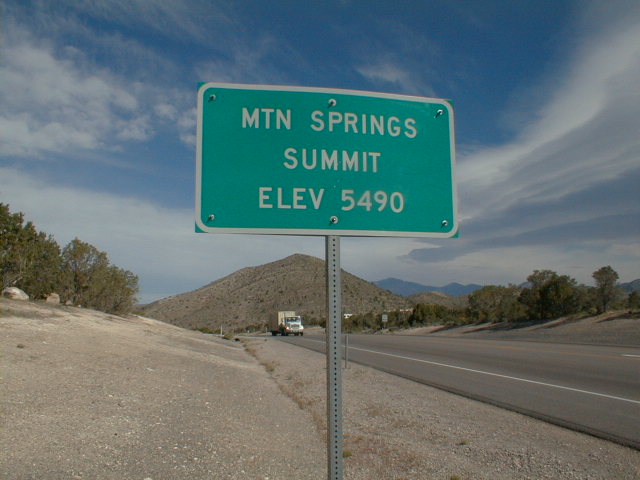
Mostly head winds on the first stretch, though the winds slowly got better over time. Particularly after turning eastward to climb Mountain Springs Summit, the wind shifted to be more from behind. Was up at the top shortly before 9am. 5490 feet, the highest point of the trip.
From the summit, another nice descent. Large open spaces and only slightly steeper/faster than I wanted to go. The route passed the dramatic rocks of Red Rock Canyons before crossing plains into Las Vegas.
We asked a surveyor for directions to the airport. He suggested the tunnel
under the runways (Paradise Avenue). Unfortunately, no obvious or easy way
to enter this on bicycle so we ended up coming up around the north side.
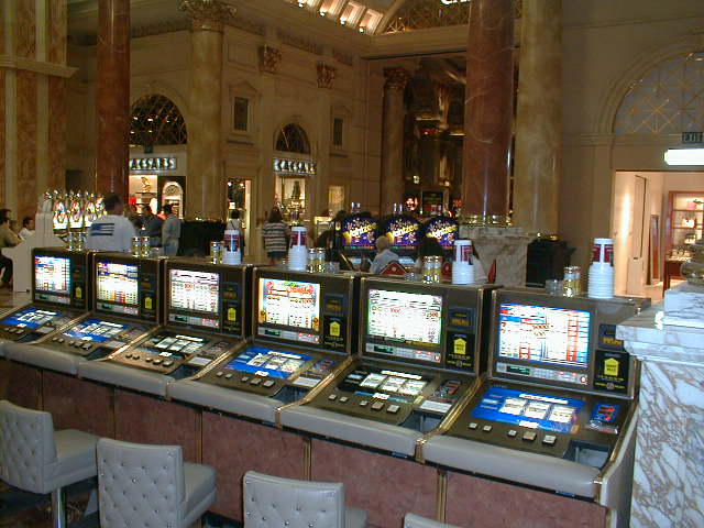
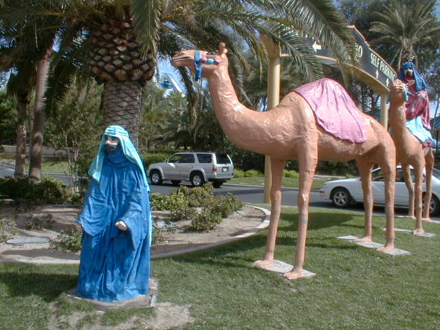
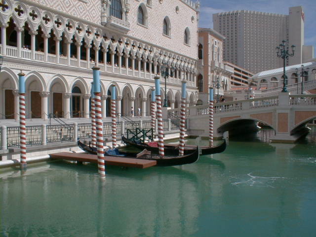
John left on Friday afternoon and I moved my tickets to Saturday. Headed into
town for one afternoon of exploring Las Vegas.
Overall, I enjoyed this ride. About the right distance and time taken to
ride it. With some exceptions noted above, fairly good roads on most of this
stretch. I might recommend this trip or the other Reno trip for someone
looking for an interesting ride from San Francisco Bay area in spring or fall.
From fruit of a successful trip come seeds for the next adventure