| mvermeulen.org : Home Blog Bike Trips |
I cycled up to the Klondike River Lodge at the start of my trip. I immediately noticed the other loaded touring bicycle leaning up against a rock. The other cyclist and myself sized each other up along with our respective equipment. He was a "sourdough", i.e. experienced on the road having just ridden the Dempster this past week. He was from Ontario, on a five week vacation, starting in Inuvik and heading south.
His tips for the road included cycling long days. He felt good about having averaged 13.5km/hr. There was a lot more loose gravel than he'd expected, so the going was a bit slow. He had made some long 16-18 hour days and completed the route in five days. Others had told him of bears, but he hadn't seen any. Just in case he mentioned making a lot of noise to scare them off. He also indicated he'd brought along a gun, "just in case". He slept beside the road. The mosquitos were ok, "just bring lots of repellent" and he had a good tent. He showed me some of his scars from slipping on the loose gravel.
I was just at the start of my trip as a "cheechako" (or tenderfoot in Chinook). I had done my share of bicycle touring before, though nothing completely like the Dempster, 450 miles of gravel road stretched over two mountain ranges and crossing the Arctic Circle. I listened to his information, thirsty for details of the road ahead, though not agreeing with him 100%. I was also eager and impatient to get started. I filled my MSR fuel bottle with 52 cents of gas, filled three water bottles, bought a few postcards and soon got ready to set off on the road ahead.
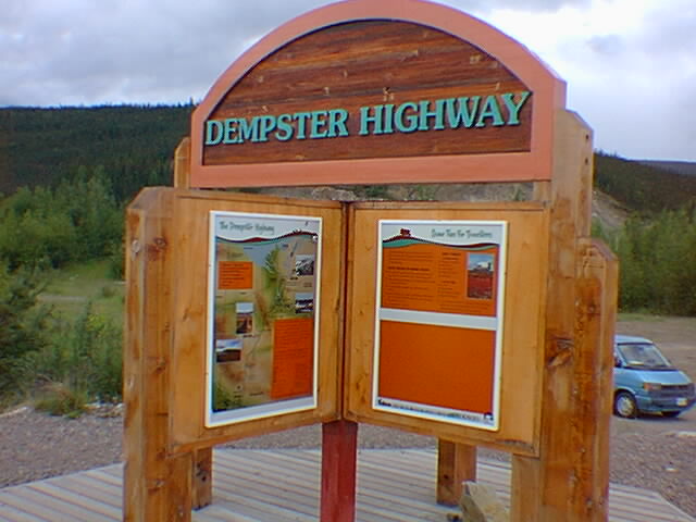
The Dempster Highway is located in the Yukon Territory. The road starts approximately 25 miles east of Dawson City. It was at Bonanza Creek, just outside Dawson that Skookum Jim Mason, George Washington Carmack and Tagish Charley had struck it rich in August 1896, starting off the Klondike Gold Rush that eventually caused thousands to come north in search of gold.
It took the early miners a month to make their way from the west coast north via steamer to Dyea, over White Pass and then down the Yukon to Dawson. Many were carrying with them over a thousand pounds of supplies for a full year. Transportation has improved dramatically since then with the opening of the Alaska Highway fifty-some years ago (1942), and the advent of air travel.
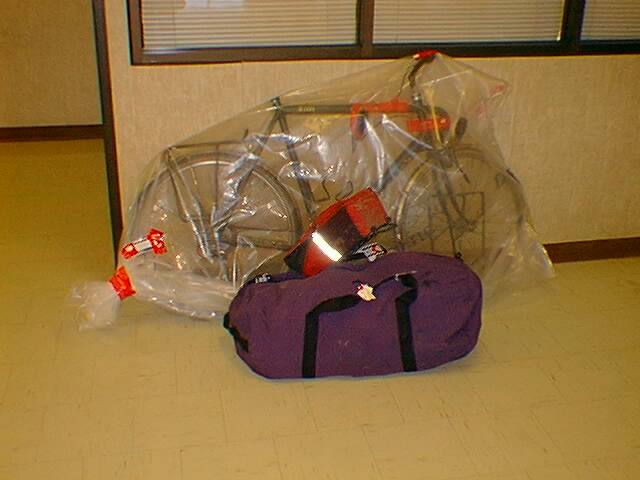
In contrast with early travelers, my trip to the start of the Dempster was one of luxury, taking only 36 hours and touching six airports. It started 5:30am Friday morning with the van taking myself, a bicycle and sixty pounds of gear to the airport. I disassembled and boxed the bicycle ($15 for the box, $50 for the flight). From Boston, I traveled via Minneapolis to Edmonton, Alberta. Edmonton was a transfer of planes to Vancouver and then Whitehorse. This cost an additional $50 for the bicycle. Whitehorse was an overnight at the Airport Inn.
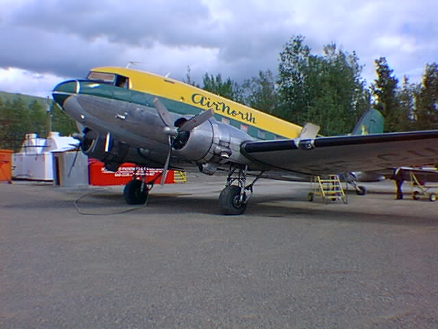
Travel from Whitehorse to Dawson is via Air North on a DC-3. Departure time was supposedly at 8am. However, close to 8am the gate agent told us they were still loading freight and it would take more time. Close to 9am, they said, "Nope, we lied, there was a mechanical problem and we were trying to fix it. We couldn't so we are swapping a new plane, we expect to leave close to 10am." Shortly past 10am, we finally boarded.
The DC-3 had seats along the side that folded against the fuselage. The front two-thirds of the seats were folded up. The front was entirely filled with boxes of cargo. I had a nice clear view of my bike box on end at the end of the cargo. In the back, eight of us sat for our trip to Dawson. The plane was unpressurized and as we got to altitude, various bags in the cargo started popping. This was a bit disconcerting until I figured it out.
About 12:30 we landed on the airstrip at Dawson. Hooray! We walked along the gravel airstrip to the terminal building. Terminal building is perhaps generous for the 20x30 ft building for waiting passengers. I unpacked my belongings and re-assembled my bicycle.
The airport is eleven miles east of Dawson. I decided to bypass town and instead head east the fourteen miles to Klondike River Lodge. This was along a paved highway and mostly level. I could definitely tell my bicycle was heavily loaded, but eagerly made my way to the start of the road.
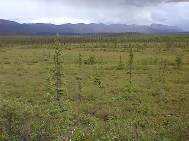
I filled my water bottles, fuel bottle and ate some snacks. I reset my altimeter to 1300ft and started shortly past 2pm. The first sign stated "Eagle Plains 363, Inuvik 735". The distances were measured in kilometers with green km posts every 2km along the road. A few kilometers down the road, I crossed an old fire burn area with dead trees still standing. The sun was shining and I was eager to get started on the road. The gravel was occasionally soft as the road slowly climbed along the valley.
At kilometer 20, it started raining. Soft rain at first, then a bit harder. I put on rain jacket and then chaps. Not too much further, I started feeling a bit sick. I hopped off my bicycle just in time to take care of a quick bout of diarrhea, yuck!
The next 30 kms were a bit miserable. The rain stopped, though it started again shortly later. I ended up making four additional stops along the way. My front tire had a flat due to a sharp stone. All the while, the road continued to climb, at times far from the river only to descend again. This wasn't the best way to start.
After km 50, things got a bit better. I continued to climb along the North Klondike valley through the mountains. The rain subsided and I felt a bit better. I slowly ground my way uphill. There was a highway maintenance camp at km 65 where the road wound its way around a bend to the north. Finally at km 71, I pulled in to the Tombstone Mountain campground. It was 9:30pm but the sun was still high in the sky.
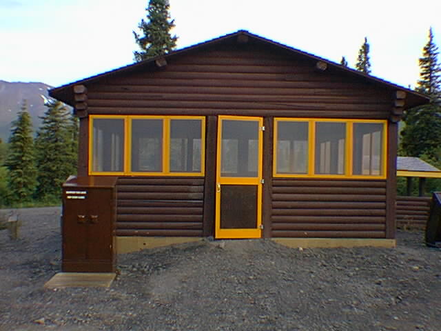
It was a nice campground with both trailer sites and a tent area. There was a large enclosed cooking area where I pulled my bicycle in and settled for the evening. I made dinner and only had to share a little cheese cake with an errant ground squirrel. I set up my tent, but early in the evening I decided to move into the enclosure to sleep.
It was cold at 6am when I awoke. As far as I could tell, it was light whenever I woke up that night. My stomach was still unsettled, so I was up several times. I slept in as much as I could, but was on the road by 7am.
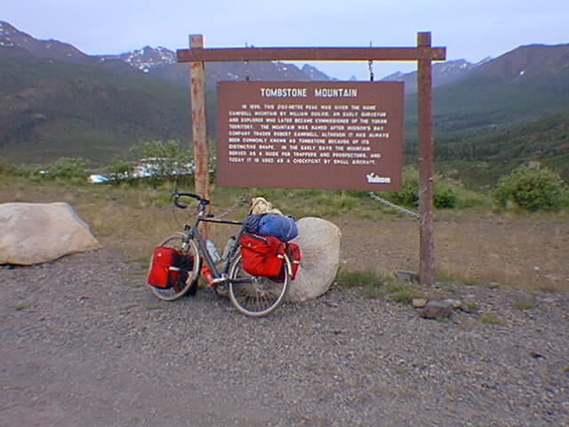
The road slowly climbed the last 1000ft of elevation to North Pass (elev 4294ft) at the continental divide. I peddled up in low gear. The views along the way up the pass were pretty dramatic. The spruce forest disappeared shortly after the campground. Tombstone Mountain and other peaks stretched off to the left of the road. It was slow, but I was up at the summit close to 8am.
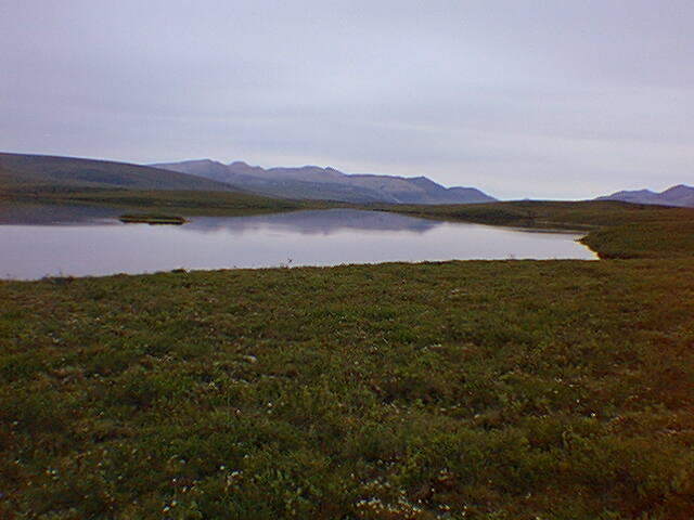
I traveled down along the Blackstone Uplands after crossing the pass. This was a region without trees, mostly tundra over permafrost. This region is known for many of the birds found here. I saw some grey ptarmigans, but not too many others. I stopped briefly at Chapman Lake at km 116 and looked at display about the sled patrols. Chapman Lake had been the original terminus of the highway until it was completed in 1979.
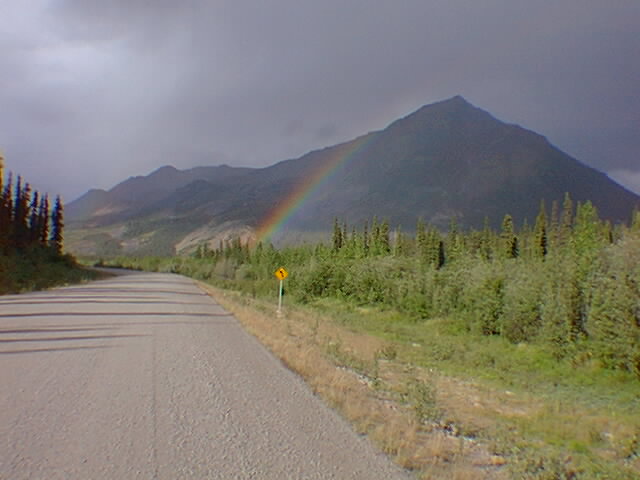
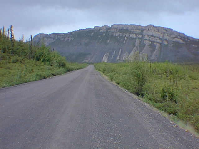
The road continued downward along the river to ~2500ft elevation at km 140 or so. At this point, the road climbed up towards and over Windy Pass at 3500ft elevation. Shortly past the summit, it started raining, real hard this time. I stopped and put on the rain suit and headed down the hill. The road got a bit rougher, but luckily it was downhill enough to continue coasting in the rain. I passed the smells of Sulphur Springs and the red iron of Red Creek.
The Engineer Creek campground was a kilometer 194. I stopped in about 4:30pm to stop for dinner. This dinner was peanut butter and crackers, dried fruit and granola bars. I also purified some water from the stream for a drink. For this trip, I had to carry all my own food. I had gone to the supermarket to put together five dinners (e.g. dried hamburger substitute, noodles and pudding), five breakfasts (e.g. granola, powdered milk, pop tarts and granola bar) and many day snacks (e.g. dried fruit, granola bars, fruit rollups, crackers and peanut butter, etc). Overall this worked well on the trip, although I found that I tended to snack all day long and hence not be interested in cooking a hot meal in the evening.
After dinner, I left Engineer Creek and bicycled down along the river for a while further. At Km 221, there was a road turnoff where I decided to stay for the evening. This concluded a good 150km day. I leaned my bicycle against the bear proof trash can. Almost immediately, the mosquitos started swarming. They were everywhere! I searched for my repellent. It had unfortunately had crushed and spilled all over my pannier.
The next best thing was to quickly set up the tent. I fought mosquitos while staking things out. It was probably one of my quickest setups ever. Once the tent was up, I zipped it open and dashed in with sleeping bag and gear. I then spent the next fifteen minutes zapping mosquitos that had made it in. Most of them were 'empty' and would be squashed against the tent. A few were 'full' and would leave little red blotches when I crushed them. Luckily, I was able to get most all of them before retiring for the evening.
I was up at 6am. So were the mosquitos. I took down the tent and the mosquitos and I quickly parted company. The route continued downhill along the Ogilvie River. At kilometer 237, I passed an emergency airstrip. In this section the trees were again large. Most places where I stopped I would quickly attract mosquito admirers, so I didn't stop much.
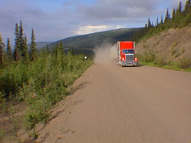
At kilometer 245, I had reason to stop. The road left the river and started up a hill. I climbed some 1300ft of elevation up to 2500ft. The road was pretty steep and I ended up walking part of the hill. Traffic on the road was sufficiently light, that I could usually pick the smoothest surface for walking or riding. On occasion, a car or truck would pass, but I would always have sufficient notice. I would hear the rumble of the vehicle as well as a large cloud of dust as the vehicle approached. In particular, the trucks drivers on the road would drive particularly fast throwing dust. I had little choice but to stand aside while they passed.
There was an expansive view at the top of the hill. I could see both down to the Ogilvie River valley below and also up north across the Eagle Plateau. After climbing the first point, there was a 300ft descent, followed by a climb across the ridge line to the next point. This next region would follow a set of ridge lines nearly 100km over to Eagle Plains. There was little water here and I had consumed nearly half my cache getting up to the top. Luckily, I ran into some campers along the way and was able to get some water from them. Not too much further, I got some more from another tourist.
For the next stretch, I followed the ridge lines slowly north. For the most part this region was wooded, although I did cross one area of forest fire burns. I slowly wound myself north to Km 350 or so. At this point, the road dramatically dropped off the plains downwards.
As I descended off the plateau, I got mentally ready for the Eagle Plains Hotel. I figured it would be down at the bottom by a river. I was wrong. While the road descended nearly 1000ft of altitude, the hotel was actually on the north side of this valley, up the next ridge. Hence, I descended first and then slowly climbed back to over 2000ft of altitude to the hotel. Finally at kilometer 369, I pulled in to the hotel.
The Eagle Plains Hotel had been built in 1978. It was along with the oil and gas discoveries of that time. These same discoveries had led to the construction of the Dempster at about the same time. At this point, the oil drilling in this region has all gone dormant due to the high costs of production.
The Eagle Plains would not allow me to keep my bicycle in my room. I also didn't feel right about keeping it outside unlocked. Hence, I let them lock it in their garage at the gas station. Unfortunately/fortunately this meant I would be forced to wait until 8am when the gas station opened.
I had a nice restful steak dinner and then evening in the hotel. It was nice to sleep in a bed and have a warm shower again. The lack of mosquitos was also a pleasant change. I did however buy new repellent before leaving.
I slept in until 6:30 and then had a leisurely breakfast at 7am. This gave me plenty of time while I waited for the gas station to open at 8am. At 8, I retrieved my bicycle, pumped up the tires, loaded things and took off down the road. Almost immediately, the road descended off the high point down more than 1000ft until the Eagle River.
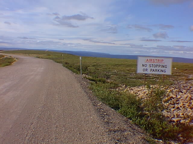
I crossed the Eagle River at the bottom of the hill and then slowly started climbing up the other side. My odometer stopped reading miles until I figured out it had become disconnected. There was a light head/cross wind as I slowly wound myself up the hill. I crossed an emergency airstrip where the road had simply been widened and signs of "do not stop" placed on the road. I was back up high and above the trees. I could see the Richardson Mountains off to the right and the valleys off to the left.
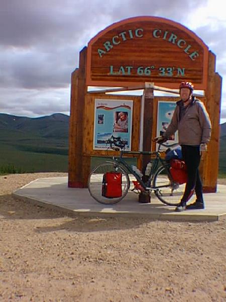
At Kilometer 405 was a turnout for the Arctic circle. I stopped and pulled in for the obligatory photo stop as well as a chance for a meal. There were several others at the stop, a couple from Michigan, a guy from California and a guy from Germany. They were all on their way up the Dempster. I found these and other folks along the road to be pretty friendly and somewhat curious about cyclists. They helped take my picture and also filled up my water bottles.
Following the Arctic Circle, the road continued up close to the Richardson Mountains. It skirted next to the mountains and across several drainages. Luckily, this was near the tops of drainages and the slopes were gentle as I crossed from one drainage to another.
The road continued skirting along the mountains until Kilometer 440 where it started a descent again to the Rock Creek. At the base of this creek was a campground at Km 446. The campground was deserted. I stopped in, had a no-cook dinner and then headed back uphill.
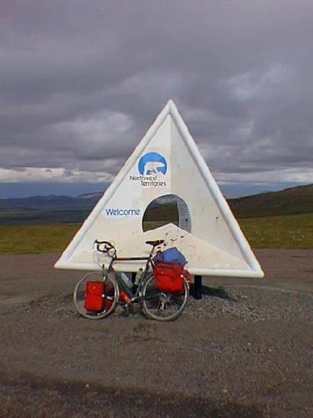
The route climbed back uphill and along the mountains. It was already late in the afternoon and so I was starting to drag some. This gravel road and elevation climb/drops definitely cut into the mileage! This entire region was above tree line. I made it up to Km 465 and the NWT border at 3500ft elevation. The last 5km were pretty steep. At the top of the pass was my last continental divide crossing. I could see the rest of the Richardson range. The Richardsons were almost completely bare of vegetation.
Across the border, the road became more narrow as it descended sharply downhill. The kilometer posts started counting again from 0 and were blue instead of green. I was pleased to be heading pretty quickly downhill.
I made it through some road construction at km10 before stopping at km14 at James Creek. I parked right beside the road and leaned my bicycle against a truck trailer. The mosquitos were moderate and I was happy to have a tent above me. The clouds had been coming in, so I was pleased to have a rain fly over my head.
I awoke at 5am to rain on the roof and a heavy fog outside. This made it not too hard to "snooze" in for a little while. Twenty minutes later it was still raining, so I snoozed again. This pattern continued until close to 8am when I decided I wouldn't be able to out wait this rain and would need to get underway.
The rain and fog continued softly as I climbed back up to Wright Pass. It was early and I was fresh so the 10km of climb went fairly rapidly. The fog and rain prevented much of a view, but I suspect it was quite pretty here. The rain was still pretty cold, so I didn't dawdle long on the summit.
The descent was pretty rapid, enough so that I ended up riding my brakes most of the way. There was no point in going down or crashing now. The cool descent meant I put on my wool mittens. The road was pretty good, although I noticed the mud was occasionally slick as I went downhill.
I passed by midway lake at km 44. Around this point, the road started getting worse. In particular, the wet hard pack started getting replaced with a softer mud. This meant a lot more effort weaving on the road to find a firm surface to bicycle on. At the lake was a music festival, though I decided not to stop now. The road also ended up periodically climbing across a hillside and descending again.
After Midway Lake the friction kept increasing as I was slipping in the soft mud. The soft mud also started periodically getting up and caught in my panniers. As a result, I ended up walking some of the distance. Somewhat after Midway, the road kept getting worse with lots of mud and slop. My speed slowed even more dramatically.
After kilometer 54, I found that I had to spend at least half the distance off pushing my bicycle along. This was even though the road was starting to descend again. The mud would frequently get up and completely stop my fenders. I realized that at this pace, it would take me until late in the day to even make it to Fort McPherson. I also started thinking more seriously about getting a ride along the way.
I was a bit torn about getting a ride. On the one hand, I wanted to make certain I really bicycled the whole distance and getting a ride would be "cheating". On the other hand, I wasn't able to bicycle anyway, and the mud was getting over everything.
My walking was noticed, as two different trucks stopped and asked if I was ok. I indicated yes, although the mud was very frustrating. Finally, when the third vehicle stopped at kilometer 58, they asked if things were ok and I said, "well actually could you give me a ride into town?" In the pickup were a couple from Watertown NY. They agreed and helped me load the bicycle in the back of the truck.
I rode the remaining distance to Fort McPherson in the truck. The first 17km were a descent of 1000ft to the Peel River. The remaining 10km were along the river and up to town. We got in around 1pm. It was cheating, but ended up being a good thing to do.
In town I met a couple from Germany who had been bicycling about half a day ahead. I had already heard of them from talks with motorists along the road. They started in the campground 10km away that morning. They had spent the morning just making it into town. They were giving up for the day as well and had now decided to try to hitch a ride back to Dawson to give up their trip. This was pretty demoralizing for them as well.
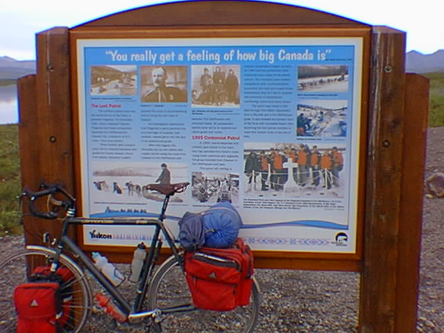
I had a nice warming lunch in the cafe and then headed out to see the town. There was a small cemetery where Inspector Fitzgerald was buried. Fitzgerald had been in command of the "lost patrol" which set off from McPherson in March 1911. They were headed towards Dawson. Unfortunately, the party didn't have their native guide, they got lost and spent fifty days wandering lost before succumbing to the cold. Corporal Dempster was among those responsible for finding the missing men. They were found just 36km from their starting point.
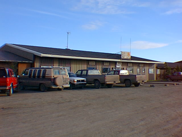
I also dropped in at the "Northern". This store was a combination grocery store and department store with just a little of everything. Fort McPherson also had the Fort McPherson Canvas shop that made bags and small souvenirs. Otherwise, the town of 800 was pretty deserted.
I had an early, and dry dinner before reading for a while and then retiring for the evening. Rain was definitely one of the drawbacks of this gravel road.
6am and I was on the road. It was still overcast, but it had remained dry for the evening. My cycling was a bit harder pushing with the extra mud. After 20km I stopped and took both wheels off. There was a considerable amount of mud caked in the fenders. I cleared this mud out and suddenly, I was able to cycle in several higher gears, yeah!
Comparatively speaking, this next stretch of road was flat. The road was damp, but luckily without mud. My speed was considerably faster than before with hills or mud, hooray! There were still a large number of mosquitos, that kept me from stopping anywhere for very long.
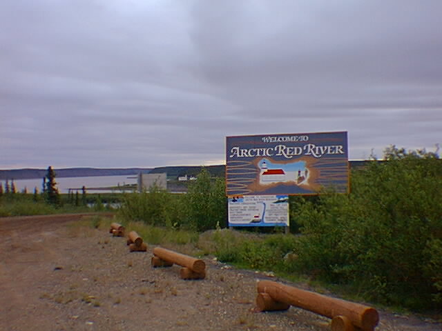
Close to 9:40am I made my way to the Arctic Red River. This was a site of a second ferry crossing. The ferry was on the other side. Its schedule was to cross the river once per hour. Hence, this meant waiting until 10:25am for the next ferry. I let it take me across to the town of Arctic Red River. In this town, I stopped in the town cafe and had a cheese burger for breakfast.
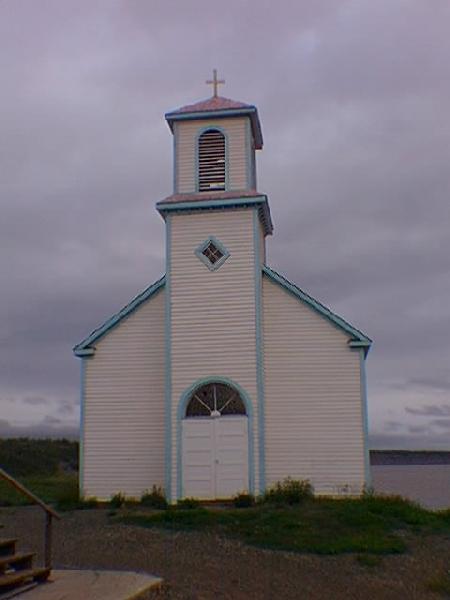
Arctic Red River was a small town of ~100 people. There was small Catholic Church dating back from the missionary days. It also had a mostly native population. The post office was only open Monday, Wednesday and Friday. Of course this was more frequent than the picture of the mail plane on the wall with a caption, "with the intro of the mail plane, mail came once per month rather than a few times per year". The bulletin board announced dates when a doctor or dentist would be in town. There were a few others in the cafe also getting ready for the day.
I caught the next ferry out of town at 11:30 and then headed up to the north bank. This was a crossing of the Mackenzie River. This river is the second largest in North America (11th in volume in the world, 10th longest river in the world) and so was pretty considerable.
I cycled along the north shore before encountering a steep hill. Luckily this was one of the last hills along this route. Above the hill, the road continued mostly straight and flat. The early morning clouds were slowly dissappating. The road dried out and became dusty.
The next section was a stretch of long flat road. There was a considerable amount of loose gravel. However, I was still able to make pretty good time as I sped towards Inuvik. While I was still 100km away, it started feeling like the home stretch!
The northbound cars on the next section of road were chunked based on the 1 hour ferry intervals. This meant most of an hour without traffic, followed by several cars coming. There were also a few cars parked along the side of the road.
Kilometer 221 was another campground where I stopped for a meal. It was already 7pm however with only 49km to go, I decided to push for Inuvik for the end of the day. I was starting to get a bit tired, but the sun was high in the sky and it all seemed so close.
Road construction at kilometer 230! This consisted of a grader bringing up all sorts of loose gravel on the road. This wasn't so bad, however it was also accompanied with a water truck wetting the gravel. This turned the loose dust to a paste that crept up and stuck to my wheels. A mini-replay as my wheels jammed up and ground to a halt. I ended up walking most of the way to kilometer 234 where I stopped and took both wheels off to clear out the mud. Unfortunately, just as I cleared out the wheels, the water truck came by to wet the next section of road. Argh! The driver of the grader stopped by on his way up. He must of taken pity on me because he offered to take me a ways north in his pickup. I thanked him, but declined. I did mention that I hoped his work would soon be over.
Finally at kilometer 240 the construction stopped and I was able to get going a bit faster. By now, I was going pretty slow at the end of a long day. The road at km 250 started going uphill and it took a long slow trip upwards. Luckily, at the top of the hill the road shifted to downwind and I suddenly also could accelerate downhill! The next eight km went pretty quickly until I came to the edge of the pavement.
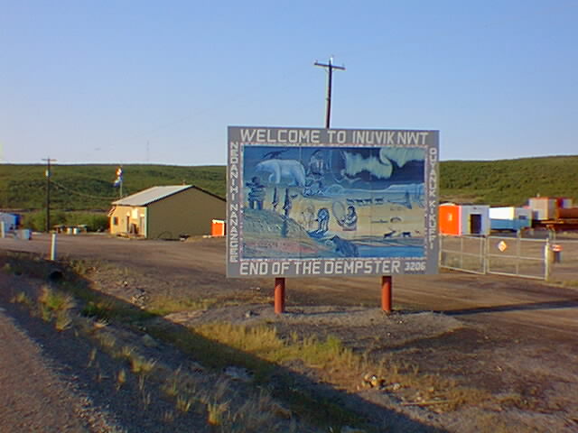
Pavement! Wow. As I cycled along on the pavement I suddenly realized the extra decrease in resistance. It was pretty dramatic. I was definitely on the home stretch now. The last 10km in to town were some of the quicker ones I had done. I made it to a motel just past 10pm. The sun was still high in the sky but I was pretty fried at the end of a sixteen hour ride.
The dining room was closed, but the bar was still open for dinner. Hawaiian Pizza. Nice celebration dinner. Not long thereafter, made it to my hotel room for a sound sleep at the end of the trip.
I had cycled the Dempster in five and a half days. A total distance of 456 miles. My average speed was 9.3 mph not including stops. This included a total climb of ~17000 feet, though a net drop of 1200 feet. I now felt a little more like the sourdough I had met at the start of my trip.
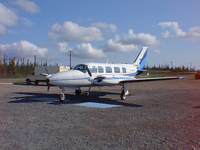
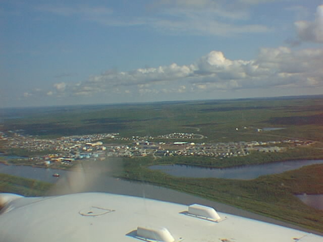
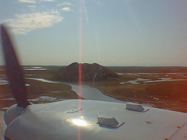
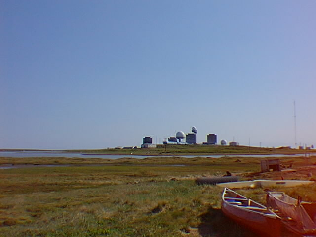
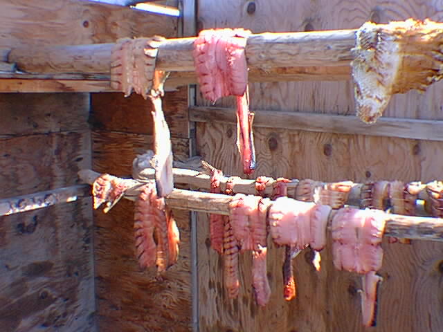
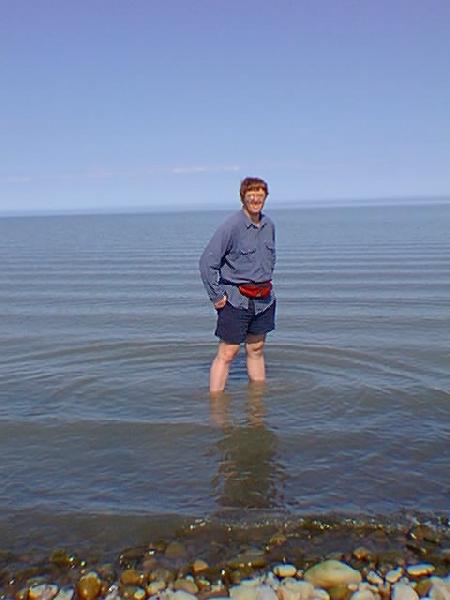
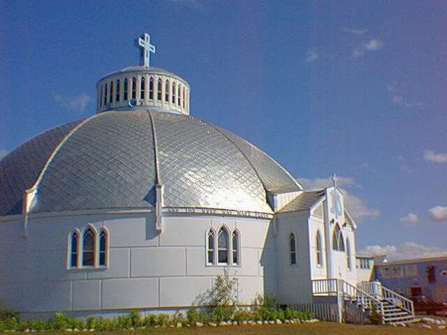
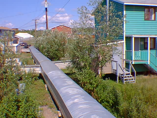
This left an extra rest day at the end of the trip. I occupied the rest day with a short flightseeing trip up to Tuktoyaktuk and the Arctic Ocean. Following are some brief snapshots from this trip and from around Inuvik.