Springfield, dodging the storms
Today I reached Springfield (at last!) and another capitol. I also sheltered from the rain twice including a tornado warning. However, I am getting ahead of myself so lets start from the beginning…

I was carefully watching the air quality charts. ~160 at 4 am. Still in the “unhealthy” range but trending the right way. All of yesterday, it had been above 200 (“very unhealthy”) and so I felt like taking a rest day was the right choice. The winds were mostly from the south but also had a little tailwind to them. Hooray!

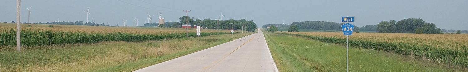
I was on the north side of town and fairly quickly back into farmland areas with my square grid of streets. The longest stretch without a turn was a 13-mile segment. There were almost no vehicles so I caught up with the news from podcasts on my bicycle speaker. With a slight tailwind, it was nice to ride along.

Still many farms along the way. Corn is the most common crop, but a lot of soybeans today. In contrast to further west, this all grows without irrigation or pumping water from underground.

Just for fun, another 360 panorama shot, showing soybeans, corn, soybeans, corn on alternating corners.
Not long after this, I started seeing lightning and hearing thunder. Still off in the distance, but looked like a line of storms was coming through. It rained a few drops and then started more heavily.

Checking my phone, looked like a brief but perhaps slightly more serious storm. I wasn’t excited about that hail indicator though didn’t look like it was going to be bad.

Up ahead by the energy transformers was a shelter. Yup, parked my bicycle by the fence and went into the port-a-john to wait out the worst rain from the storm and hail if it arrived (it didn’t). It was clean and dry. When the worst of the storm was past, I took this photo and got back on the bicycle for the rest of the ride.

On the outskirts of Springfield was a cafe for a brunch and a break before riding the last bit into Springfield.

Air quality was now “moderate” and finally below 100 on the scale. Nice to finally get less particulates in the air.

Next stop was the post office. I had ordered a map from Adventure Cycling for their “Route 66” segment that goes between St Louis and Chicago. I was particularly interested in the map segments that got me into Chicago. I had actually stopped by the post office Monday but they couldn’t locate my package until my second visit today.
As I went to leave, the skies were ominous dark. I went to check my phone to see about any storm. If necessary, I figured I could wait out a strong thunderstorm/rainstorm in this large concrete building.

Tornado warning! A tornado was spotted west of town and quickly heading east. Pretty quickly, postal staff gathered everyone including customers like myself and led us into the building and the storm shelter. By now the power was out and only emergency lights or portable flashlights to illuminate things. By the time I got there, there were already ~30 people inside the storm shelter. The main building was a large warehouse area including sorting tracks and package machines. The area off to the side had a concrete roof and was more safer. People were eagerly using their phones to contact others and small reports also came in this way. Trees down, lots of wind damage, loss of power, etc. It was a fun exercise.
After ~30 minutes the tornado warning had expired but power wasn’t back on. Postal employees still needed to wait because there wasn’t much they could do without power, but eventually someone realized that customers such as myself no longer needed to stay – and someone found a flashlight and led us out.
Here is an article from the local newspaper. It talks about strong winds and ~30,000 customers losing power.
As I cycled through rest of Springfield, I could see a lot of tree branches down. Even if not a direct hit from a tornado, the strong winds seem to have caused some damage. Many traffic lights had switched into blinking red mode. Springfield is a railroad town and along my route was a train blocking the tracks and not moving. I found a street parallel to the tracks and followed it until I found an underpass.

At last, found my way to the State Capitol for the obligatory picture.

Here is a selfie I tried since there weren’t as many people out walking around.

On Monday, I was also here and visited the Lincoln Presidential Library a few blocks from my hotel. I left my tent, sleeping bag and some other things at the hotel, so now will need to pack them back with my gear.

Since I had seen the mural of the Lincoln Funeral Train in Cambridge City on June 9th, I took this photo that explained the overall train route.
Nice to reach another capitol and pick up my Adventure Cycling map for the next leg to Chicago. It took a little bit of storm dodging today but also let me see a part of the Springfield post office not normally on the tourist route. Strava posting below. Note: If you click on and examine the Strava posting carefully, you’ll notice that something strange happened with the elevation just after the storm. Not sure why but I didn’t suddenly zoom up to 1400ft…
WP Strava ERROR 403 Forbidden - See full error by addingdefine( 'WPSTRAVA_DEBUG', true );
to wp-config.php
Wow, first bedbugs and now this. It’s shaping up to be an adventure.