Annapolis, avoiding road closures
Today the ride started with a visit to Annapolis. It was almost ideal cycling weather, cool around 50F to 60F. It wasn’t a very difficult route, with about 2300 ft climbed but after 58 miles I was ready to stop. I think this has been my longest day ride since 2020 so also need to ease into things. It would have been ~53 miles but I had a few detours and closures described below.
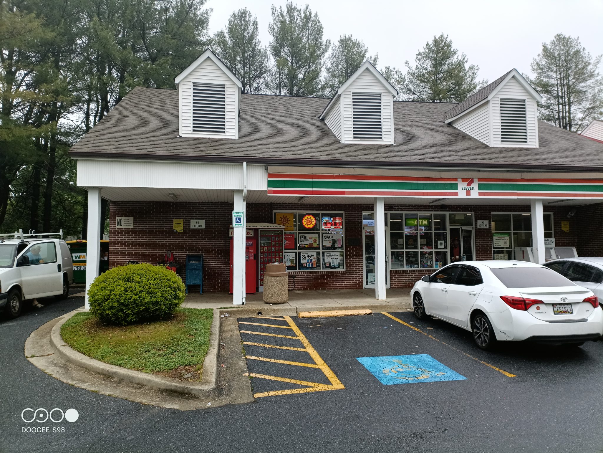
It started out with cool temperatures but fortunately dry. The roads leaving Washington were bumpy and had just enough small rolling hill to keep me pedaling up/down. However, overall the route I had chosen was reasonable so far. Not long after leaving bumpy streets I came past more suburban areas of Woodmere. At 16.5 miles, took my first break at a 7-11
It was shortly after this that I encountered the first of three road closures for the day. As background it is useful to understand the experiments I’ve used in picking my routes. When I started cycling, I mostly used paper maps but until recently, I would use Google Maps on a PC the day before – figure out a rough route and write it down on note cards. If during the day, I wasn’t quite sure, I’d check a map or more recently a cell phone.
Prior to the trip, I started experimenting with creating maps offline and downloading them onto my cycle computer to show me when to turn. There are a variety of apps that can create these route (Komoot, Strava, RideWithGPS, MapMyRide) and today I was using a Komoot route. I had downloaded. The first detour happened around mile 19 because Komoot hadn’t updated maps to include a bridge that closed. I got first indication of this when I saw the picture below.
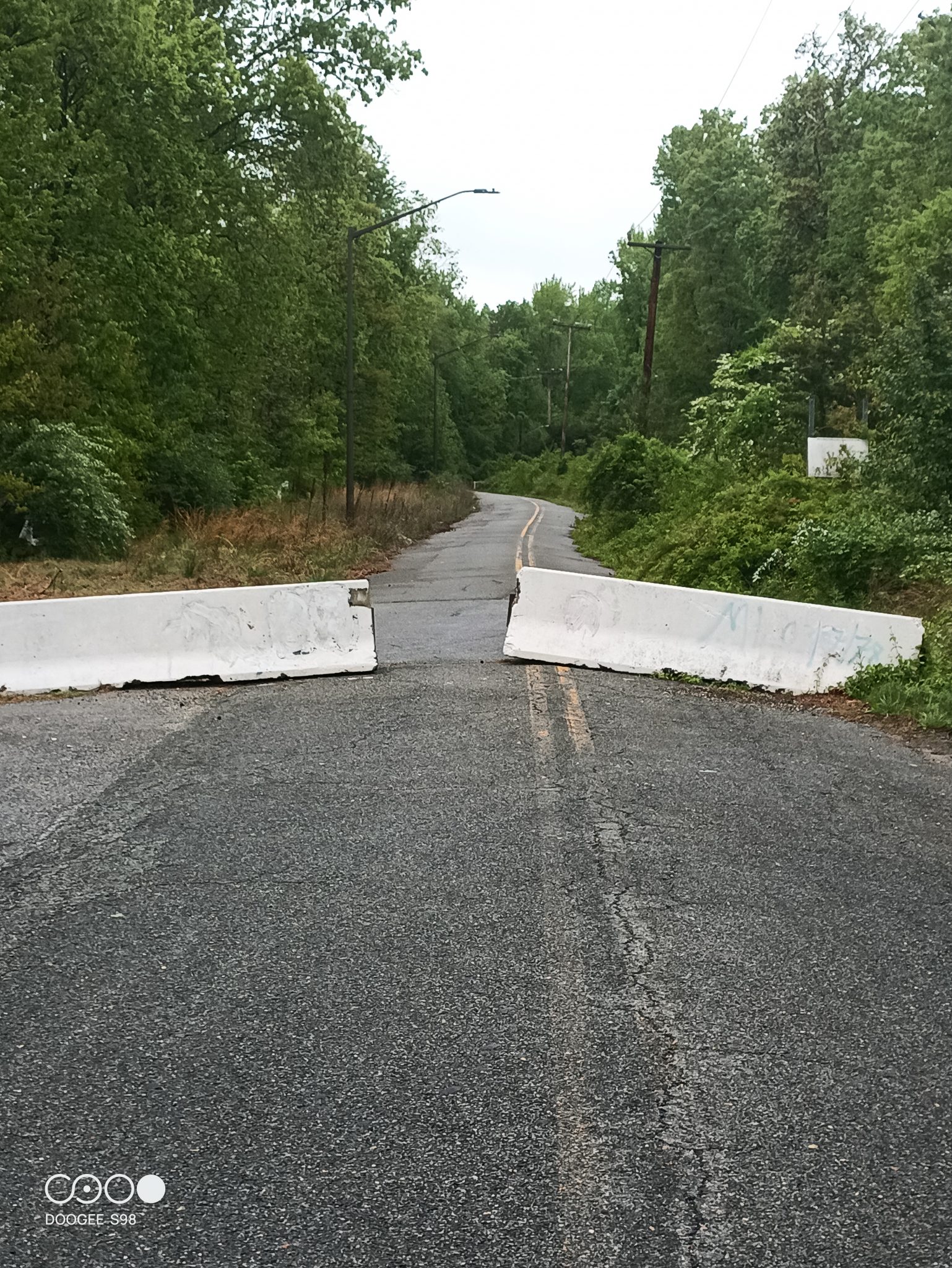
Here my cell phone and Google Maps did tell me the bridge had closed, so Komoot didn’t have up to date information. Well sometimes a bridge is closed and sometimes it is *really* closed and since I was not too far, I went past those barriers perhaps half a mile further to check and saw the following below.
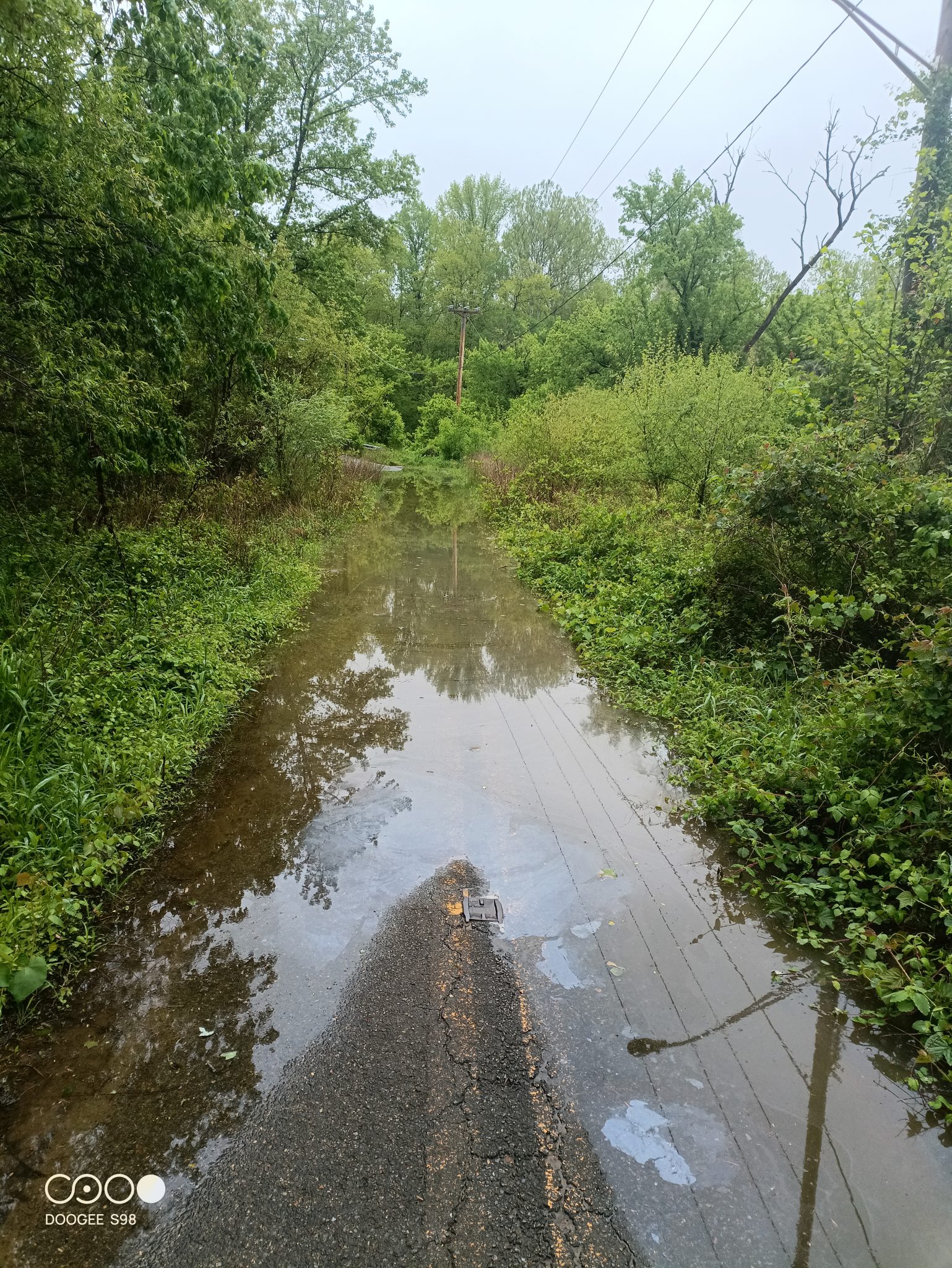
This wasn’t the real river/bridge yet and in my younger life I might have waded in, gotten my feet wet and gone at least through this muck. However, it didn’t look particularly clean and at this point, I decided to cut my losses and cycle back a little over a mile to the turnoff and find an alternate route. Fortunately, Google Maps as a backup gave a suggestion.
From this point, the next five miles or so, my GPS unit was going crazy. It kept telling me to turn on little roads to somehow loop back and make another try at that closed bridge. Eventually after five miles it stopped and couldn’t figure anything out. By then I was back on the main road and at 28.8 miles, I got to the second closure for the day.
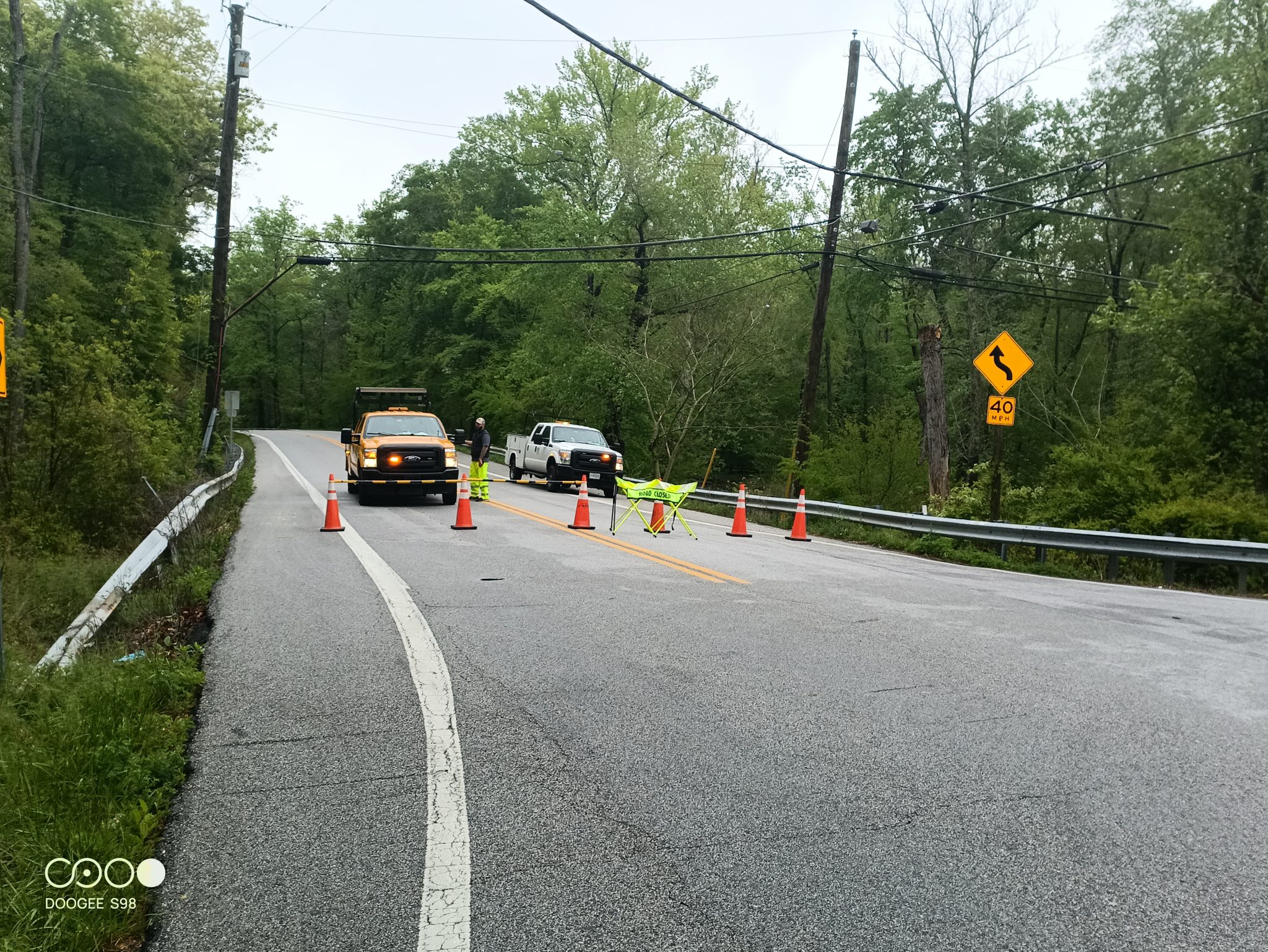
Those vehicles are Maryland Department of Transportation (MDOT) and were kind enough to let me know the storm from day before had knocked trees into power lines. I asked but they told me it wasn’t safe to go past on a bicycle. So, they told me there was a detour that seemed to add more than 10 miles to my route. Once again, checked with Google Maps and there seemed to be a closer detour that added about 3 miles.
This little road was steep! The hills weren’t long, but tested my low gears. One small one was steep enough and I was tired enough, that I just got off and pushed up the hill. So I was happy to finally get around this detour and back to the main road.
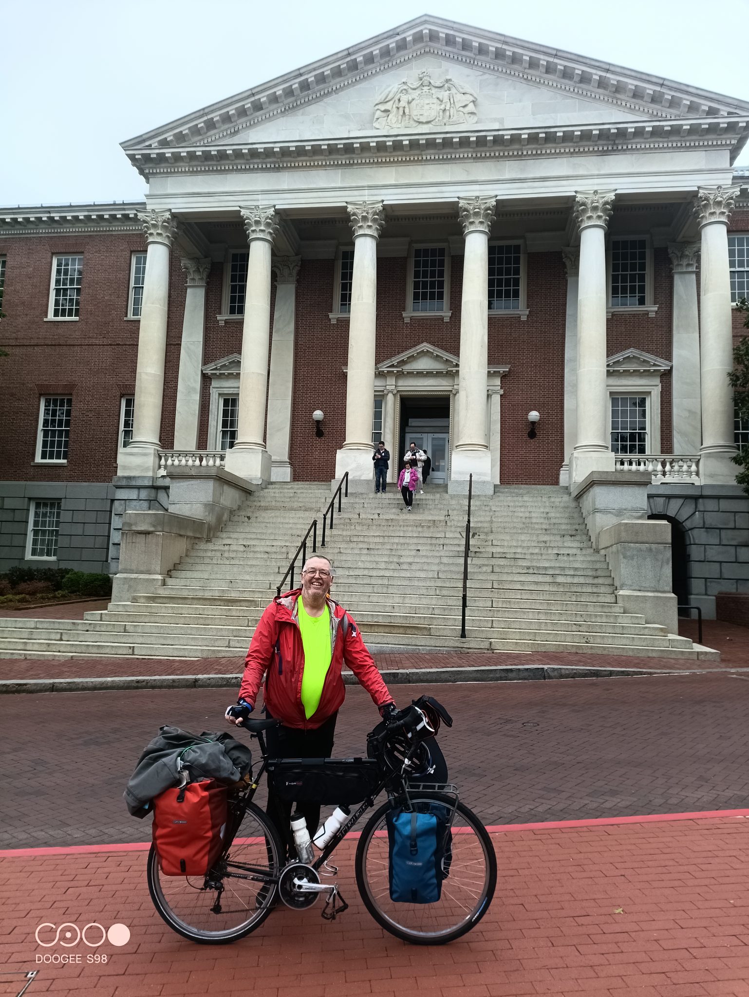
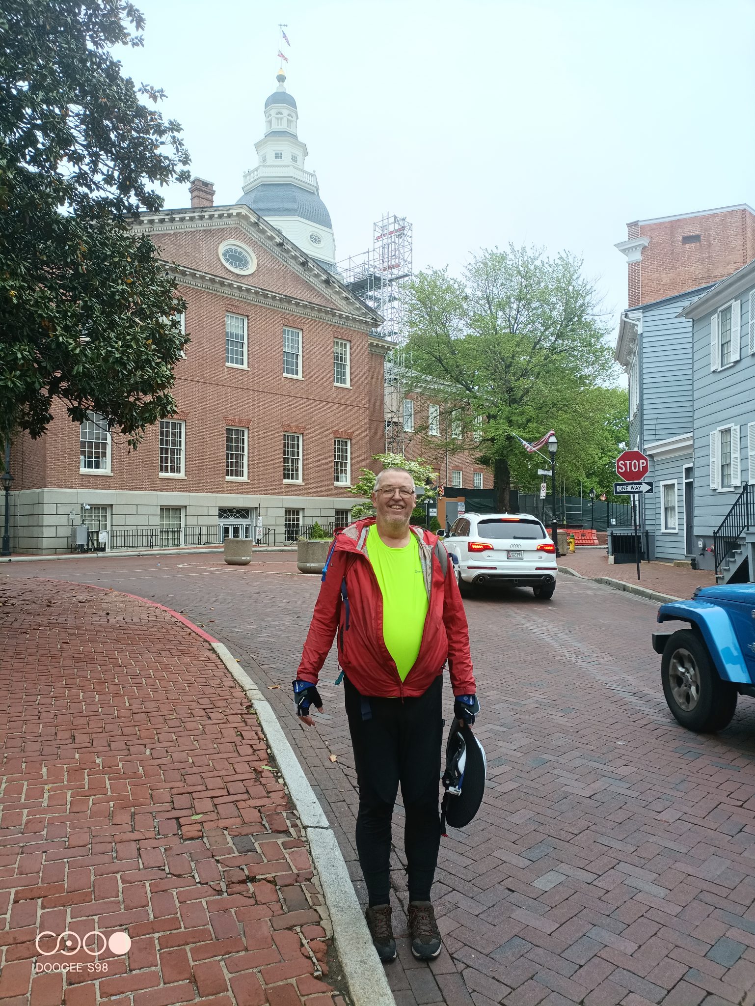
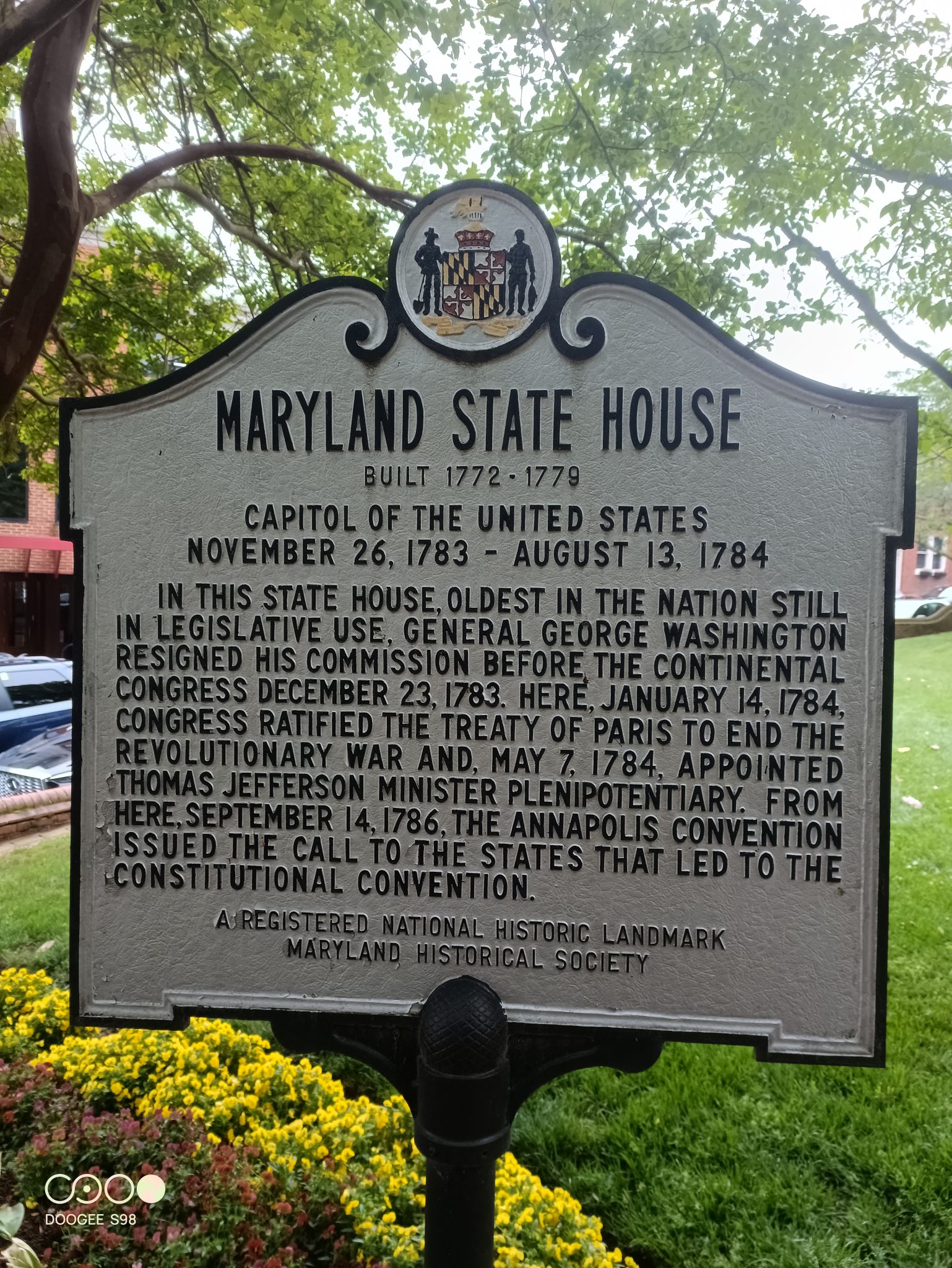
It kept getting busier and busier until I was in downtown Annapolis. I spotted a spire ahead… must be the State House. This was a false alarm, but it wasn’t much further. Time for an obligatory photo or two.
What I found particularly interesting, is there was a small park with statue of Thurgood Marshall. Marshall was a native of Maryland who was a leading lawyer for NAACP, before becoming Solicitor General and eventually a Supreme Court Justice. Prior to the trip, I had read “Devil in the Grove: Thurgood Marshall, the Groveland Boys and the Dawn of a New America”. I recommend the book and it helped me understand what a truly amazing life Marshall led.
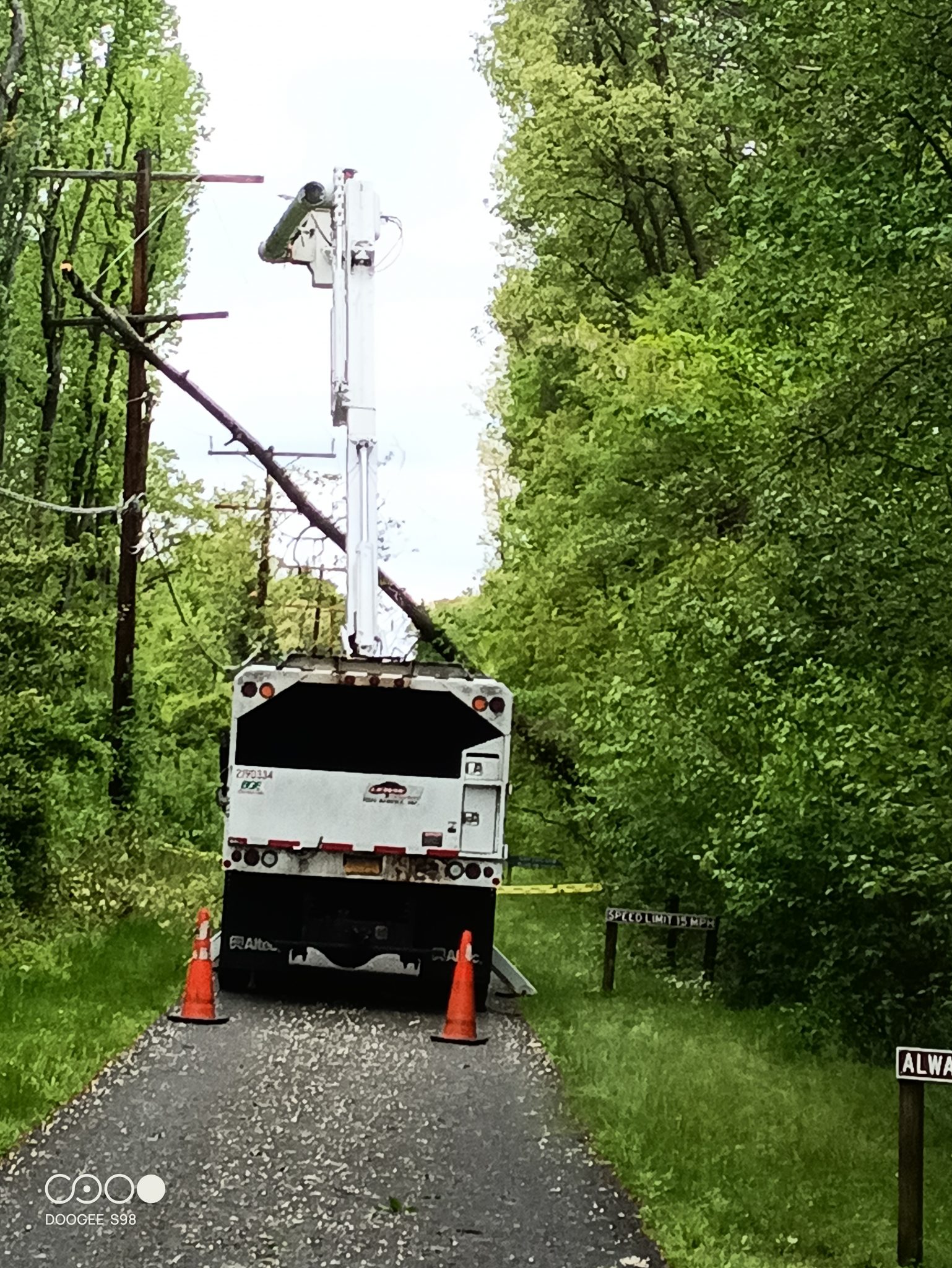
After the State House, time to find lunch. I had spotted a cafe specializing in potatoes that looked interesting. However, they didn’t have much in way of seating, so I headed outbound and a 42.5 miles stopped at a Subway on the way out. By now, I had joined the Baltimore/Annapolis bike trail. It still had slight hills but was a nice break from traffic. It was also this trail, I got to the third closure of the day.
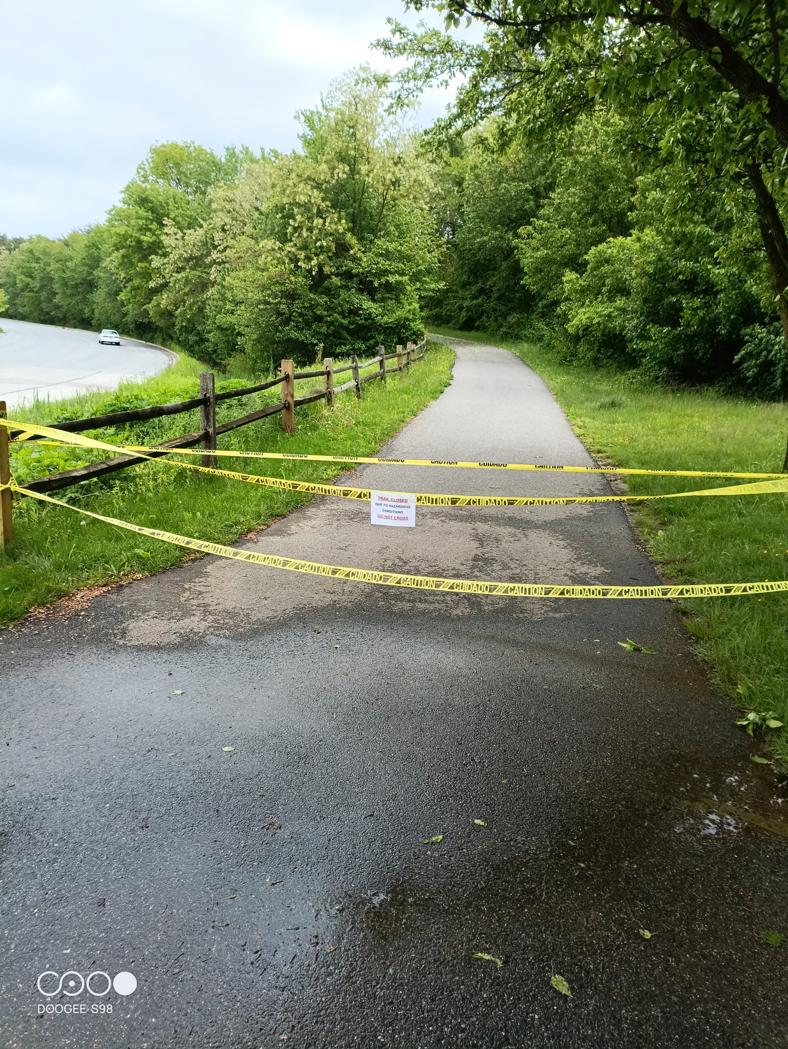
Except, I didn’t see a blockage like the one above, since this after I passed the closure. Instead, I came upon three utility trucks blocking the trail itself. Once again the storm had knocked a tree into the power lines. They were using a cherry picker to extract the tree. I was fortunate they let me carefully pass including walking under that leaning tree.
After this some rather busy roads to a motel I had reserved a bit earlier. I am not too far from the BWI airport. Tomorrow looks like another rain day with some storms coming through particularly in the afternoon. However, my thought is to try crossing Baltimore on a early Sunday morning and ride until it stops being fun for the day – so might be a shorter day if it ends up being pretty wet.
I am not quite sure why my Strava plugin stopped being included with maps, but here is the strava listing for today. Garmin tells me: 58.15 miles, 2313 feet climbed, 4759 calories burned, 5:52:35 moving time and 9.9 mph average moving speed.
WP Strava ERROR 403 Forbidden - See full error by addingdefine( 'WPSTRAVA_DEBUG', true );
to wp-config.php