Columbus, into the big city
Hooray, nice to reach my next state capitol. It has taken 15 days of riding the Erie Canal, Lake Erie shoreline and ETOT since Albany so nice to reach this point.
The first two thirds of today were easy cycling on relatively smooth rail trails with a few little road sections. The last third became tougher with a lot of stop/go, a detour and cycling into the middle of a city with ~900,000 residents. It was nice to get to the capitol and find a hotel nearby.

There were four other cyclists at breakfast at 6am. The others were headed the other direction and had more aggressive mileage goals. I think I was the first out and right away I started on the Heart of Ohio trail for 17 miles. It was smooth and easy riding.
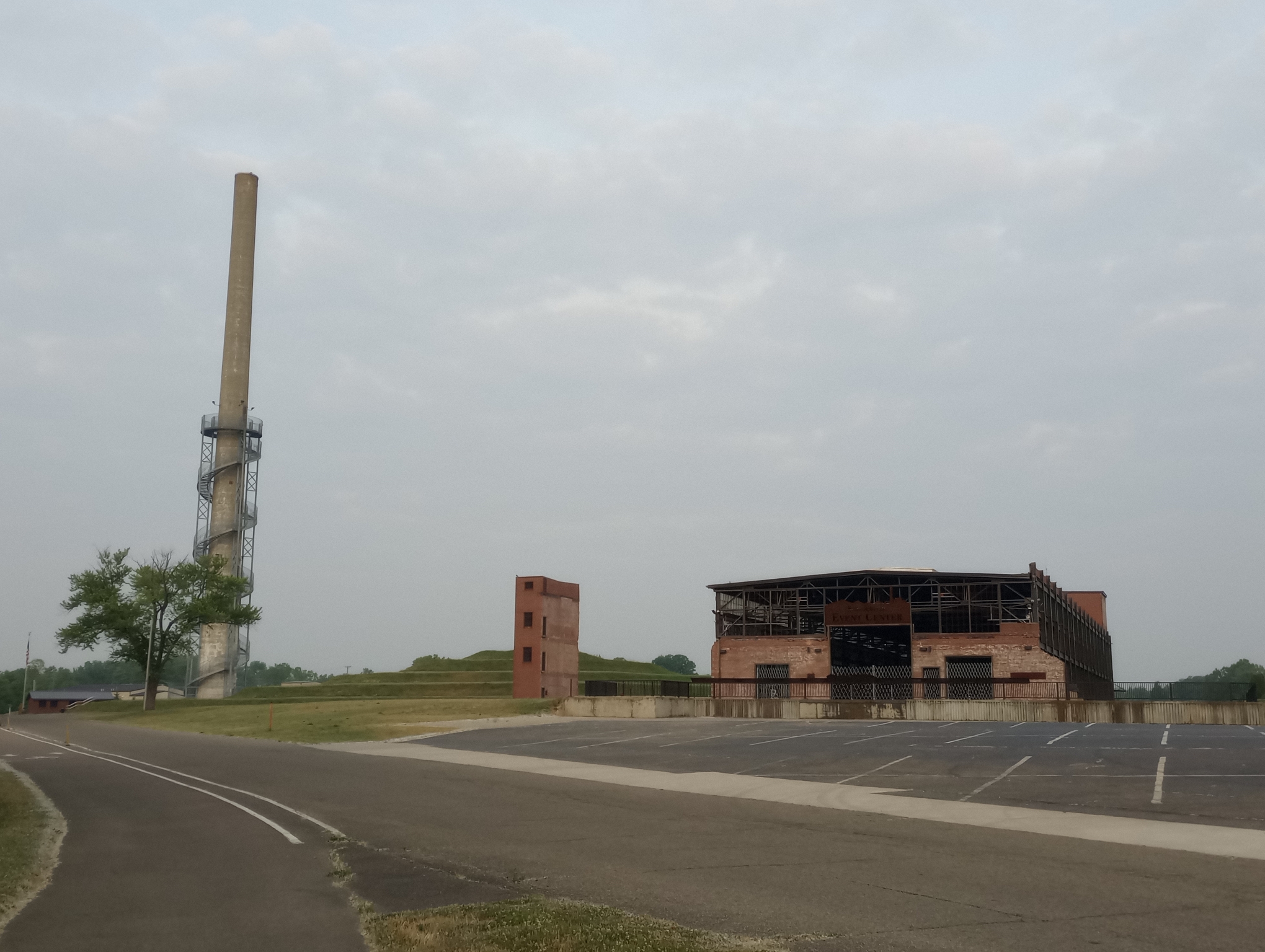
In the first mile was this intriguing building. Made from an abandoned factory, it was now an events center and recreation venue.
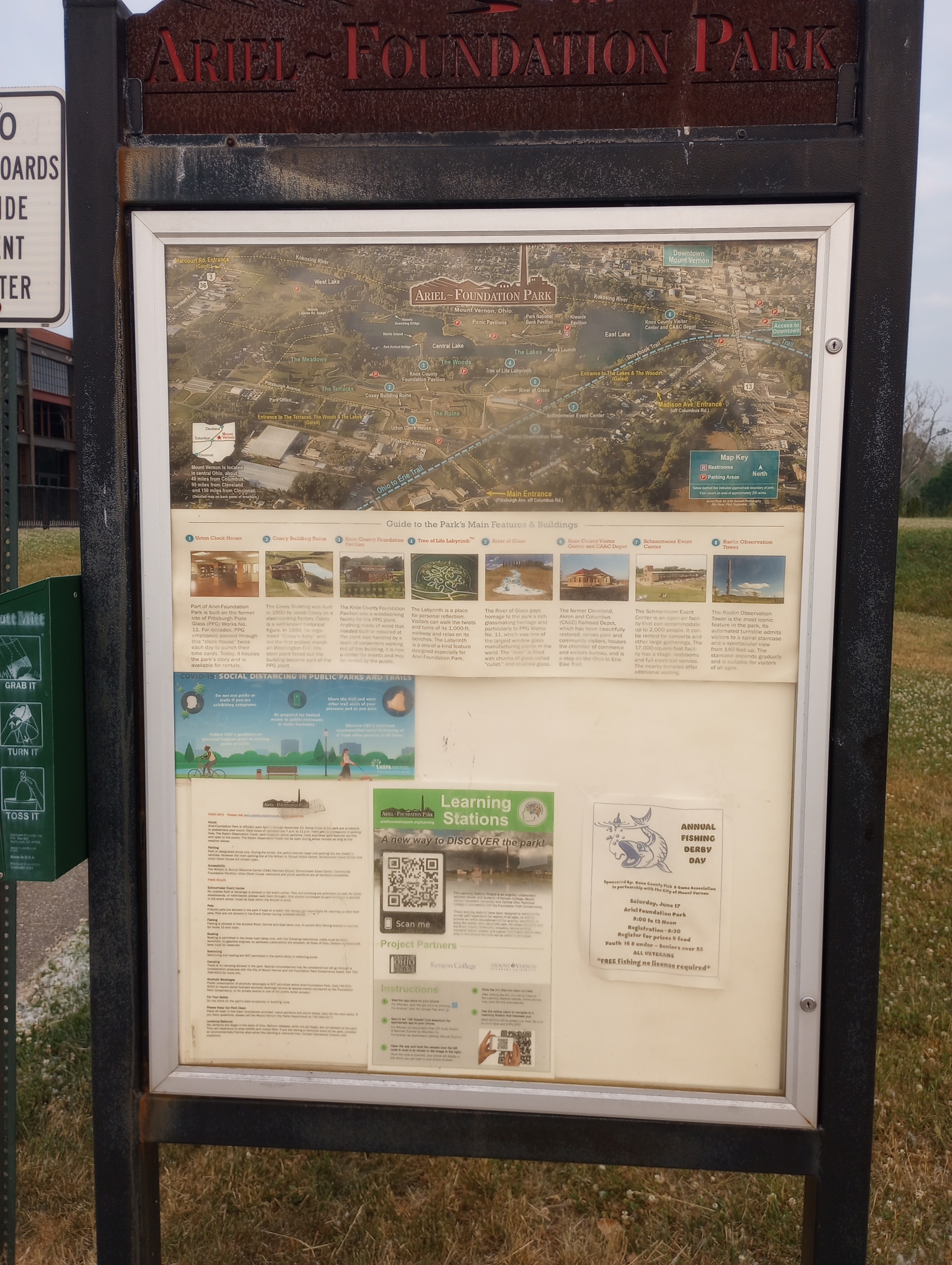
Here is the sign describing more about it.
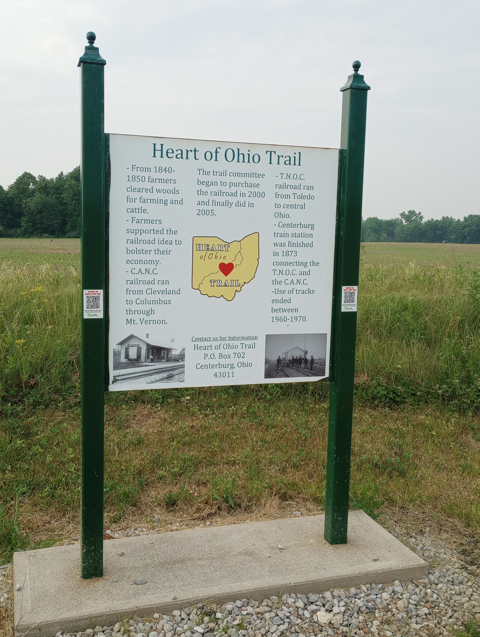
Heart of Ohio Trail.
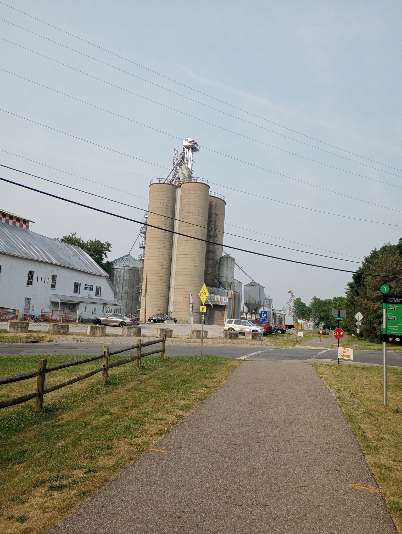
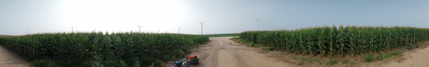
I expect to see more silos coming up, but here is one of the first.

This bench and playground was a nice mid-morning break spot. After this the route became rougher.
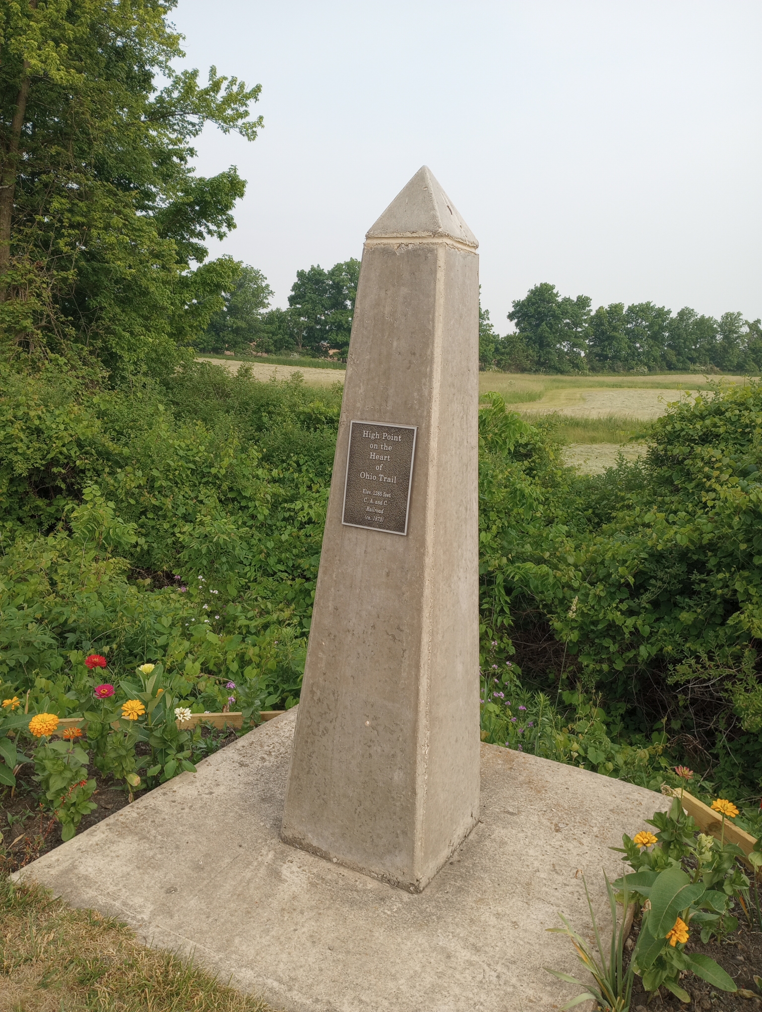
High point, slight downhill after this.
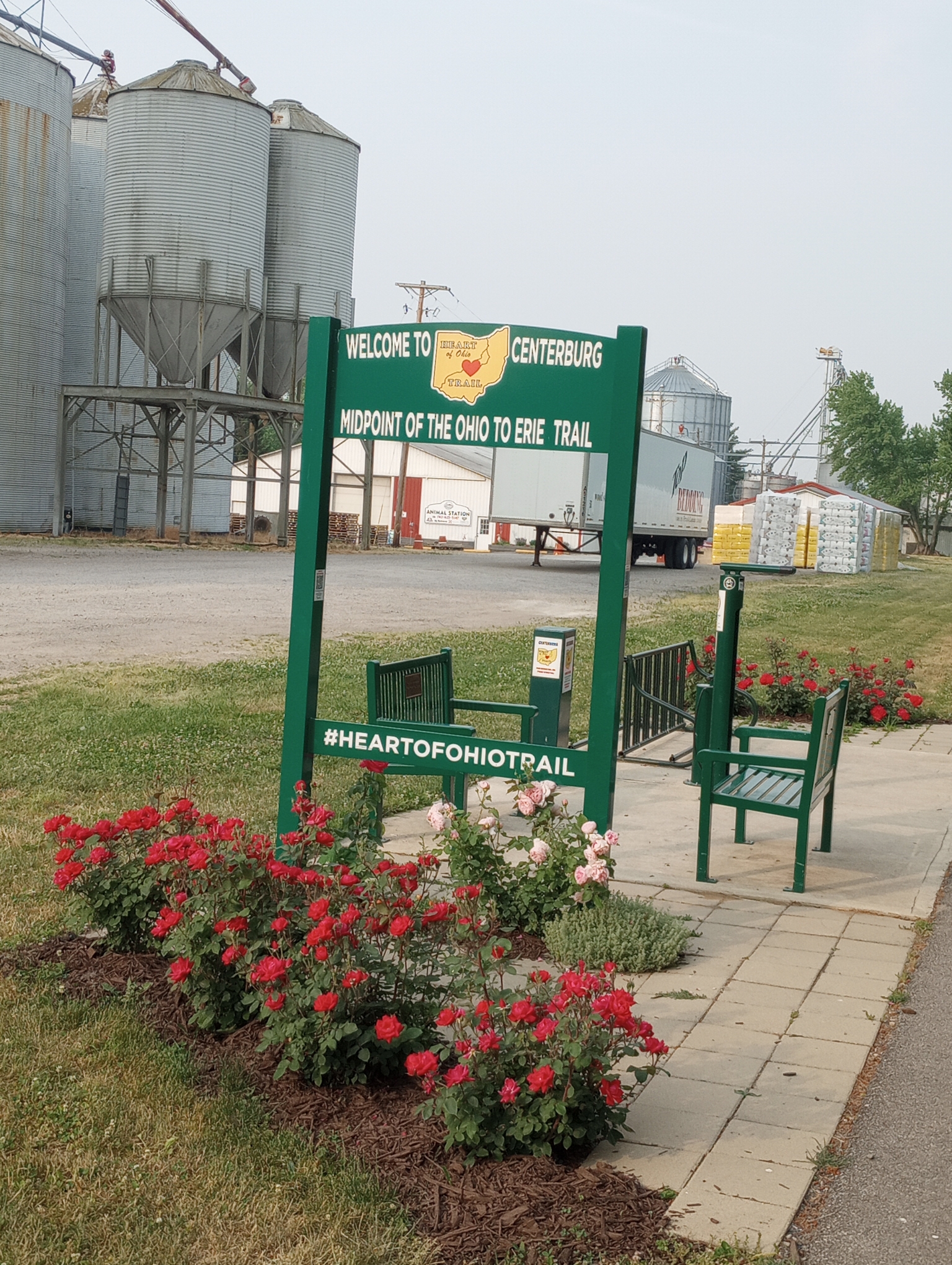
Midpoint of OTET which goes from Cincinnati to Cleveland

Trail celebration coming up.
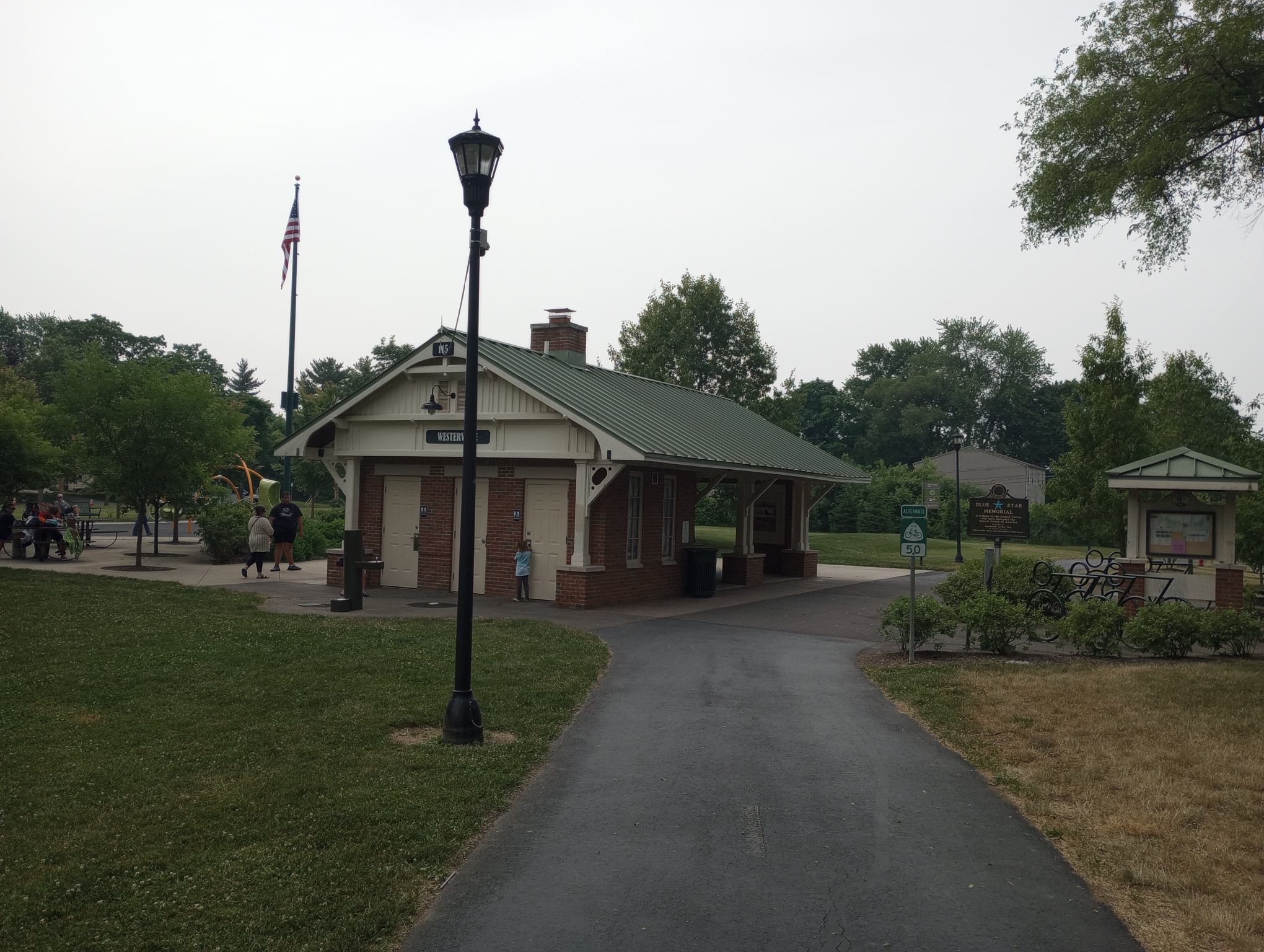
Westerville depot. This is where the riding became rougher. The trail went through a busy area with stops at every little road and numerous turns. The larger roads would have you stop and push a walk button, wait for the light and then repeat the same thing three times in a mile. It was slower going.

Eventually I got myself onto the Alum Creek trail that normally could bring me close to downtown. However even before this photo was taken, there was a trail closure. The OTET page https://ohiotoerietrail.org/content.aspx?page_id=22&club_id=146576&module_id=562105 says a three month closure and suggests alternatives like riding the bus or taking another trail ~20 miles around. That wasn’t going to work.
Since I was close to both lunch and 40 miles, I found a nearby Wendy’s restaurant and sorted things out. I used my map application to plot a detour that added a few miles and used surface streets.
This was close to a large mall area. The impression I got cycling this area was different from Canton. There were some bike lanes, some share the road markings, working pedestrian lights, crosswalks and sidewalks. No cars honked. There was still one section that had a narrow shoulder but traffic was well-behaved.
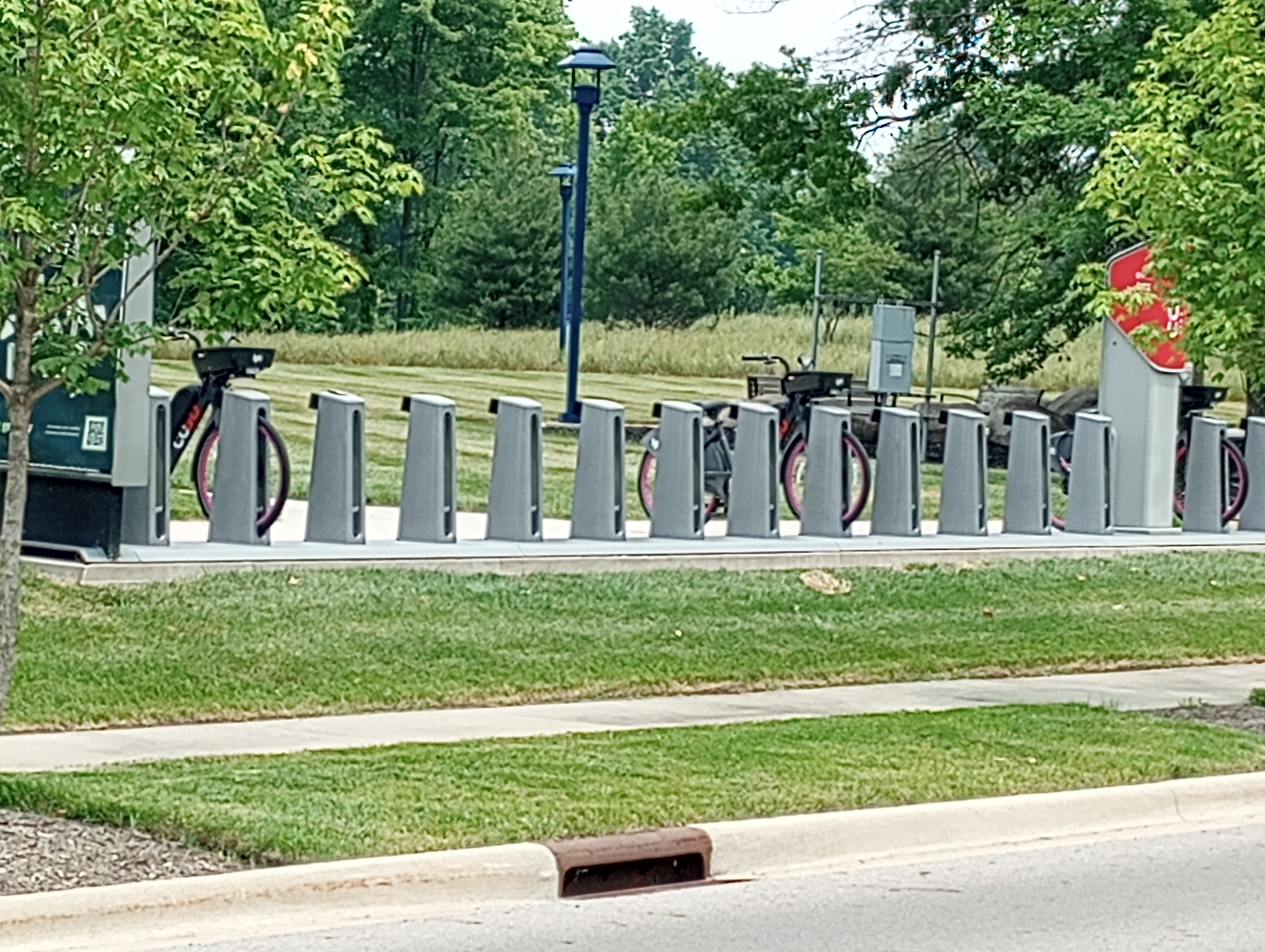
Even a section with a bike rental station. This part of Columbus outskirts gave me a different impression than Northeast Ohio. What sealed the deal is as I was leaving the Wendy’s a young woman looked at me and asked if I was bikepacking. I said I was touring and had been on the road six weeks. Did I have a place to stay? She and here roommate were bikepacking fans. I declined the offer but a big shift from an area where motorists tell cyclists to get off the roads to one where someone is inviting a stranger to stay over. Not the same Ohio…
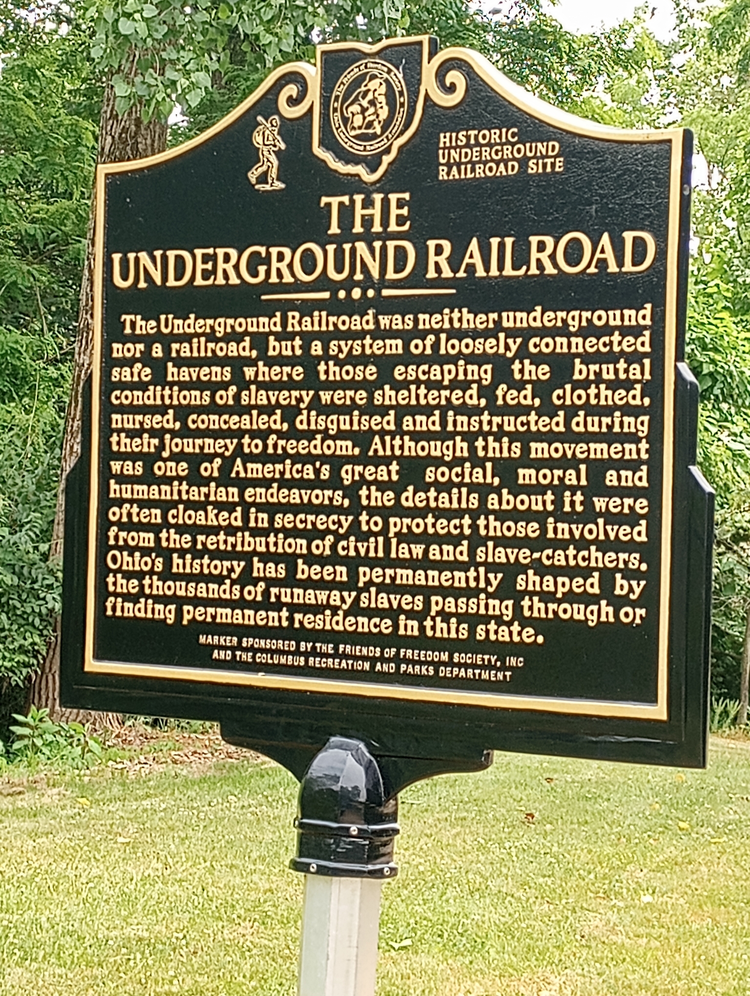
Historic marker. The last few miles were busy with turns and small hills.
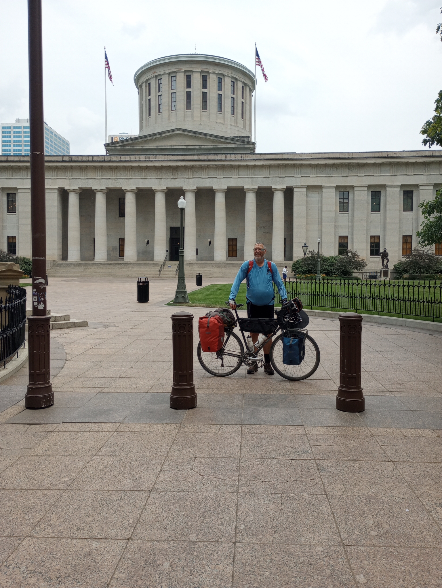
The Ohio State Capitol. Hooray! Nice to reach here. From here I picked up an Amazon package and went to one hotel before realizing there is a difference between Holiday Inn and Holiday Inn Express and I was at the wrong one. Figured it all out but the last third of the day definitely was tougher.
Strava says: 56.39 miles in 6:18:14 for 8.9 miles/hour. A total of 978 feet climbed and 3504 calories burned.
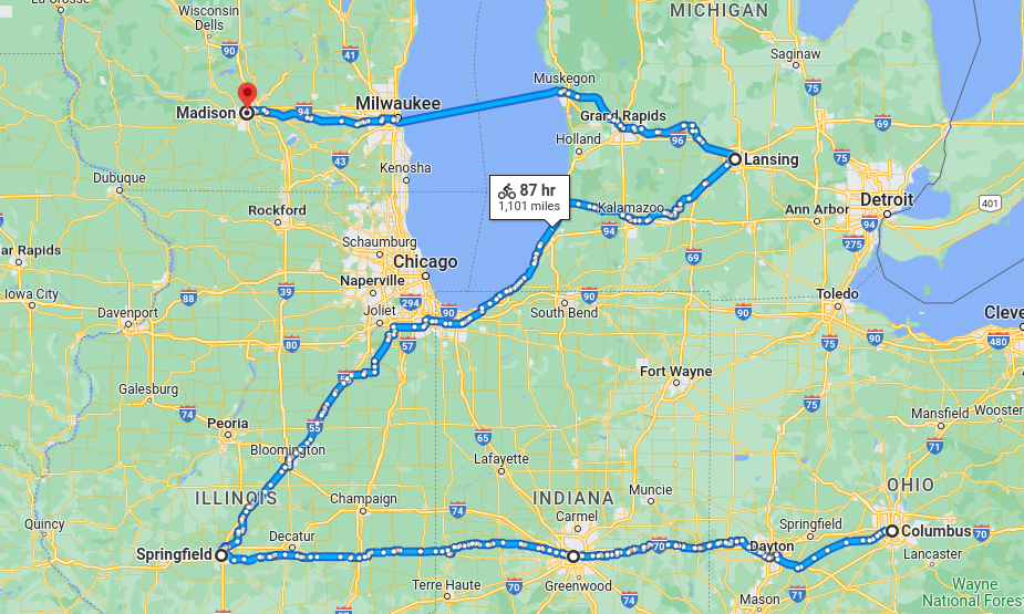
Where to from here? I’ve been thinking of this the last days as I’ve approached Columbus. I originally had four potential choices:
- Charleston, West Virginia. While I skipped this along with Harrisburg to make an easier crossing of the Appalachians – I considered doing a one-way trip and then renting a car for return. While the hills are certainly easier than what they would have been from Harrisburg, I also soured some on rural Ohio roads and so decided not to go there.
- Frankfort, Kentucky. Somewhat more hills than Charleston and with some of the same issues.
- Lansing, Michigan. I definitely still want to reach this capitol and perhaps a zig north and zag back to Indianapolis?
- Indianapolis, Indiana. Do the zig/zag in the other direction, heading west first and then coming back to get Lansing.
The last two choices were somewhat similar and in the end I think I’ll head west first and then try circling back. This should also give me slightly more time in my schedule. I’ve been fortunate so far with weather (except for first wet days, I’ve been able to ride every day) and at some point perhaps take a rest day or two to do something other than bicycle. That makes the approximate next four cities something like the picture below.
I’ve also found a few resources along the way: Adventure Cycling has a Chicago to New York route where I’ll try following the Columbus to Indianapolis section. From Springfield north at least towards Chicago, Adventure Cycling has their Route 66 where I”ll try following things until close to Chicago.
WP Strava ERROR 403 Forbidden - See full error by addingdefine( 'WPSTRAVA_DEBUG', true );
to wp-config.php